
Image: RCAF Guelph Aerial View

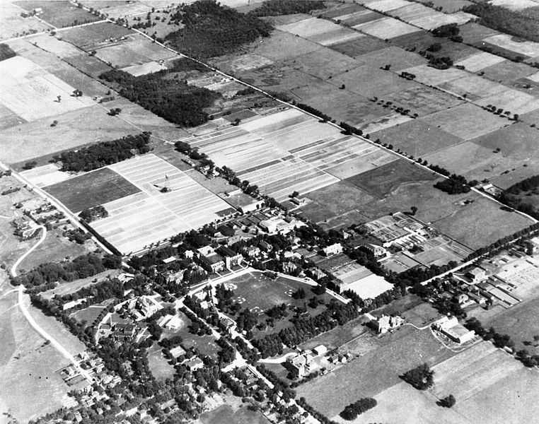
Description: This aerial photograph shows the campus of the University of Guelph as it was when the Royal Canadian Air Force used it for No. 4 Wireless School. The date of the photograph is unknown but it probably would be summer of 1942, 1943, or 1944. Johnston Hall is near the centre of the frame. The H-hut barracks at the Cutten Fields clubhouse (mid-left), the Armaments Building on Macdonald Street, the L-shaped Motor Transport Garage, and the Parade Square are clearly visible. The gravel road from the Cutten Fields clubhouse to University Avenue East was built by the RCAF to provide access to the club. College Avenue was blocked by the security fence erected by the RCAF.
Title: RCAF Guelph Aerial View
Credit: Commonwealth Air Training Plan Museum, Brandon, Manitoba, Canada via Flight Ontario Website
Author: Unknown authorUnknown author
Usage Terms: Public domain
License: Public domain
Attribution Required?: No
Image usage
The following page links to this image:
