
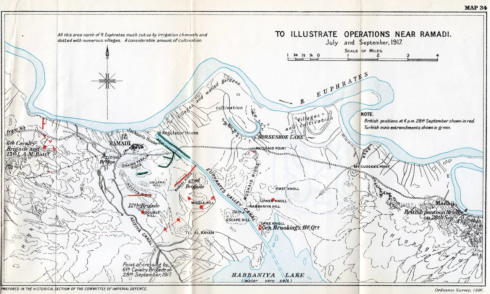
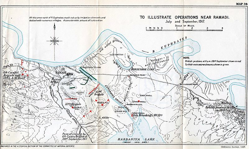
Image: Ramadi operations map 1917
Size of this preview: 800 × 481 pixels. Other resolutions: 320 × 192 pixels | 3,612 × 2,170 pixels.
Original image (3,612 × 2,170 pixels, file size: 1.63 MB, MIME type: image/jpeg)
Description: Map of British operations in Ramadi, July and September 1917
Title: Ramadi operations map 1917
Credit: Moberly, Frederick James (1927). The Campaign in Mesopotamia 1914–1918, vol. IV
Author: Ordnance Survey
Usage Terms: Public domain
License: Public domain
Attribution Required?: No
Image usage
The following page links to this image:

All content from Kiddle encyclopedia articles (including the article images and facts) can be freely used under Attribution-ShareAlike license, unless stated otherwise.