
Image: Randolph TN map ca 1835
No higher resolution available.
Randolph_TN_map_ca_1835.jpg (800 × 518 pixels, file size: 248 KB, MIME type: image/jpeg)
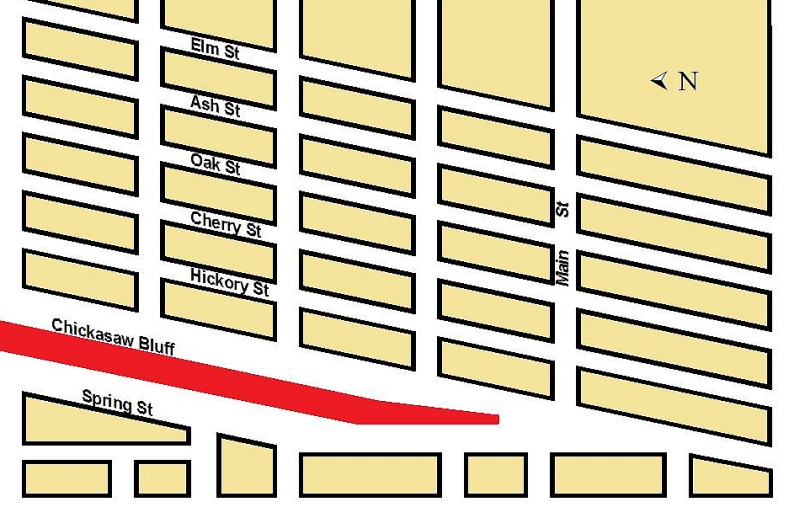
Description: Street map of Randolph, Tipton County, Tennessee, ca. 1835. Map is not to scale, but showing approximate alignment of streets. North is to the left. Second Chickasaw Bluff
Title: Randolph TN map ca 1835
Credit: Own work
Author: Thomas R Machnitzki
Usage Terms: Creative Commons Attribution-Share Alike 3.0
License: CC BY-SA 3.0
License Link: http://creativecommons.org/licenses/by-sa/3.0
Attribution Required?: Yes
Image usage
The following page links to this image:

All content from Kiddle encyclopedia articles (including the article images and facts) can be freely used under Attribution-ShareAlike license, unless stated otherwise.