
Image: Raymond Battlefield Mississippi
Size of this preview: 780 × 600 pixels. Other resolutions: 312 × 240 pixels | 1,040 × 800 pixels.
Original image (1,040 × 800 pixels, file size: 405 KB, MIME type: image/jpeg)
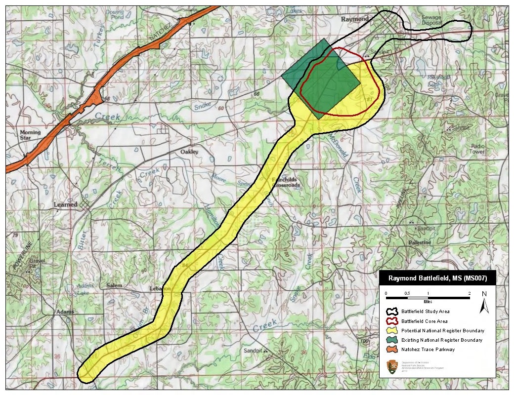
Description: Map of battlefield core and study areas. The ABPP redrew Raymond’s Study Area to better represent the full extent of the battlefield and associated troop movements. Corridors and locations used by combatants to move from the Core Area to support areas were added, including the Federal approach route from the south and the Confederate route of withdrawal and encampment in the northeast. The ABPP reduced the battlefield Core Area to remove locations where fighting is unconfirmed by primary sources.
Title: Raymond Battlefield Mississippi
Credit: National Park Service
Author: American Battlefield Protection Program
Usage Terms: Public domain
License: Public domain
Attribution Required?: No
Image usage
The following page links to this image:

All content from Kiddle encyclopedia articles (including the article images and facts) can be freely used under Attribution-ShareAlike license, unless stated otherwise.