
Image: Red-blue-purple view of counties

Size of this preview: 800 × 534 pixels. Other resolutions: 320 × 213 pixels | 1,024 × 683 pixels.
Original image (1,024 × 683 pixels, file size: 388 KB, MIME type: image/png)
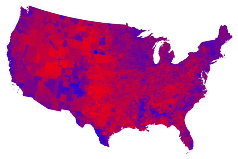
Description: This map is used to scale the votes in the counties.
Title: Red-blue-purple view of counties
Credit: http://www-personal.umich.edu/~mejn/election/2012/
Author: M. E. J. Newman
Usage Terms: Creative Commons Attribution 1.0
License: CC BY 1.0
License Link: http://creativecommons.org/licenses/by/1.0
Attribution Required?: Yes
Image usage
The following page links to this image:

All content from Kiddle encyclopedia articles (including the article images and facts) can be freely used under Attribution-ShareAlike license, unless stated otherwise.