
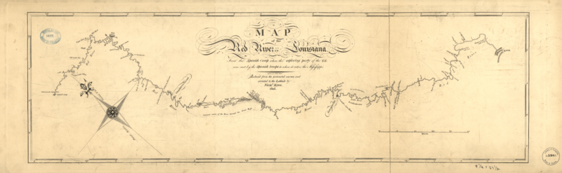
Image: Red River Exp 1806 map

Size of this preview: 800 × 247 pixels. Other resolutions: 320 × 99 pixels | 9,287 × 2,862 pixels.
Original image (9,287 × 2,862 pixels, file size: 18.95 MB, MIME type: image/png)
Description: Map of the 1806 Red River Expedition. Published Nich. King in 1806. Copy is from the Library of Congress site.[1] Sorry it's so large but it's not really legible much smaller.
Title: Red River Exp 1806 map
Credit: Library of Congress site
Author: Nich. King
Usage Terms: Public domain
License: Public domain
Attribution Required?: No
Image usage
The following page links to this image:

All content from Kiddle encyclopedia articles (including the article images and facts) can be freely used under Attribution-ShareAlike license, unless stated otherwise.