
Image: Regions of South Africa 1

Size of this preview: 800 × 558 pixels. Other resolutions: 320 × 223 pixels | 2,000 × 1,394 pixels.
Original image (2,000 × 1,394 pixels, file size: 771 KB, MIME type: image/png)
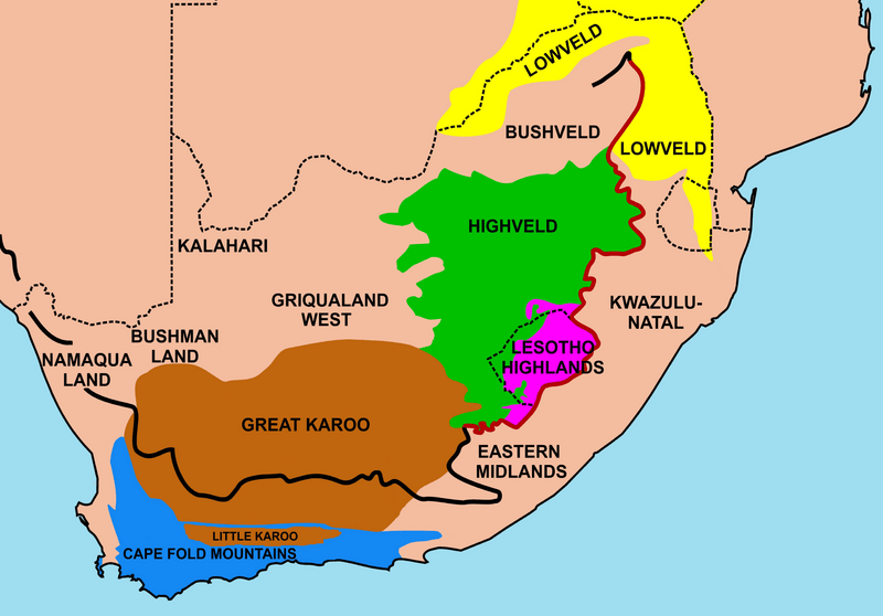
Description: Map of the main regions of South Africa. The best known ones are colored in, the others are named as they would have been in an atlas. None of the regions has sharp clearly defined borders, except where a mountain range or the escarpment provides a clear boundary.
Title: Regions of South Africa 1
Credit: Own work
Author: Oggmus
Usage Terms: Creative Commons Attribution-Share Alike 3.0
License: CC BY-SA 3.0
License Link: http://creativecommons.org/licenses/by-sa/3.0
Attribution Required?: Yes
Image usage
The following page links to this image:

All content from Kiddle encyclopedia articles (including the article images and facts) can be freely used under Attribution-ShareAlike license, unless stated otherwise.