
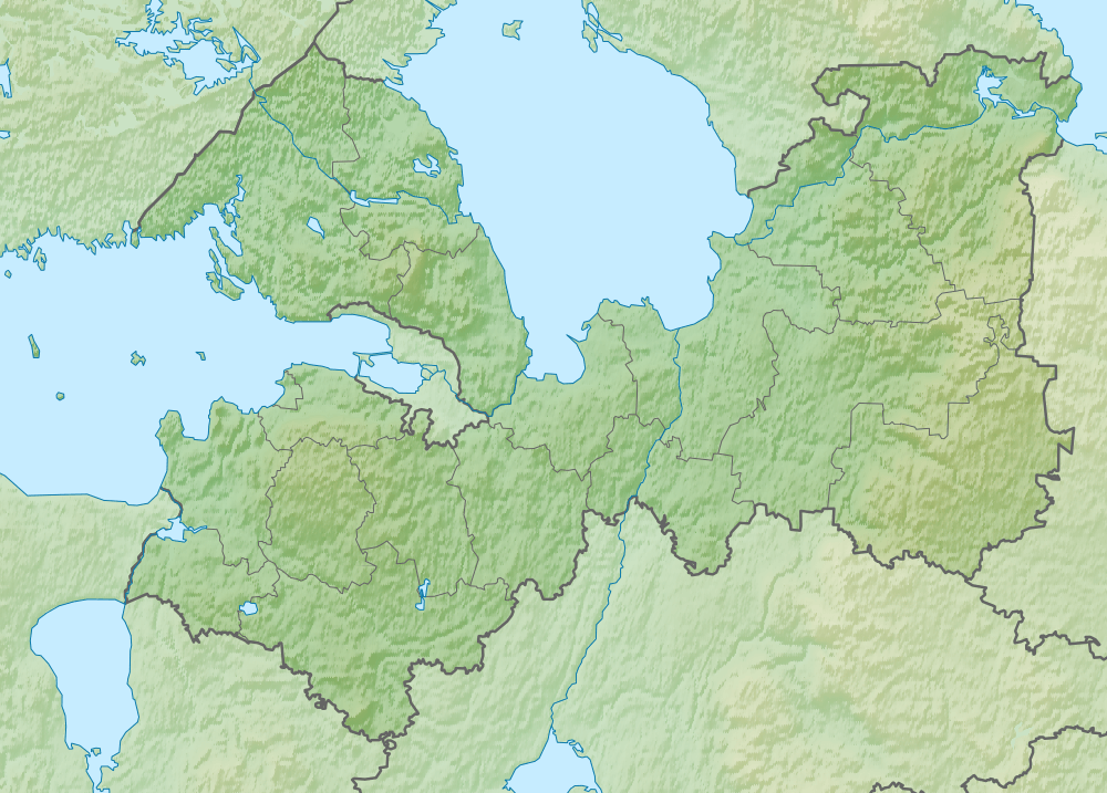
Image: Relief Map of Leningrad Oblast
Size of this preview: 800 × 574 pixels. Other resolutions: 320 × 229 pixels | 1,000 × 717 pixels.
Original image (1,000 × 717 pixels, file size: 1 MB, MIME type: image/png)
Description: Topographic map of Leningrad Oblast (darker green) — in Northwest European Russia. Showing the Baltic Sea (left), Lake Ladoga (center top, large), and the Karelian Isthmus (between them, darker green). The city of Saint Petersburg is the light green area on the Baltic's easternmost bay, south of the Isthmus. Finland is in northwest (upper left corner).
Title: Relief Map of Leningrad Oblast
Credit: File:Outline Map of Leningrad Oblast.svg ETOPO1
Author: Виктор В
Usage Terms: Public domain
License: Public domain
Attribution Required?: No
Image usage
The following page links to this image:

All content from Kiddle encyclopedia articles (including the article images and facts) can be freely used under Attribution-ShareAlike license, unless stated otherwise.