
Image: Relief map of Santa Clara Valley

Size of this preview: 523 × 599 pixels. Other resolutions: 209 × 240 pixels | 681 × 780 pixels.
Original image (681 × 780 pixels, file size: 301 KB, MIME type: image/png)
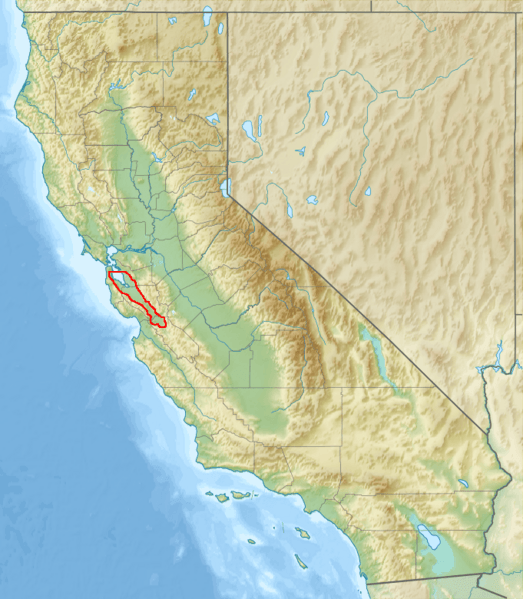
Description: The Santa Clara Valley of California is shown stretching south-southeast 90 miles from San Francisco to Hollister. The Santa Cruz Mountains form the western border, and the Diablo Range forms the eastern border. The northern border runs across the San Francisco Bay.
Title: Relief map of Santa Clara Valley
Credit: File:Relief_map_of_California.png
Author: User:Nzeemin
Usage Terms: Creative Commons Attribution-Share Alike 3.0
License: CC BY-SA 3.0
License Link: https://creativecommons.org/licenses/by-sa/3.0
Attribution Required?: Yes
Image usage
The following page links to this image:

All content from Kiddle encyclopedia articles (including the article images and facts) can be freely used under Attribution-ShareAlike license, unless stated otherwise.