
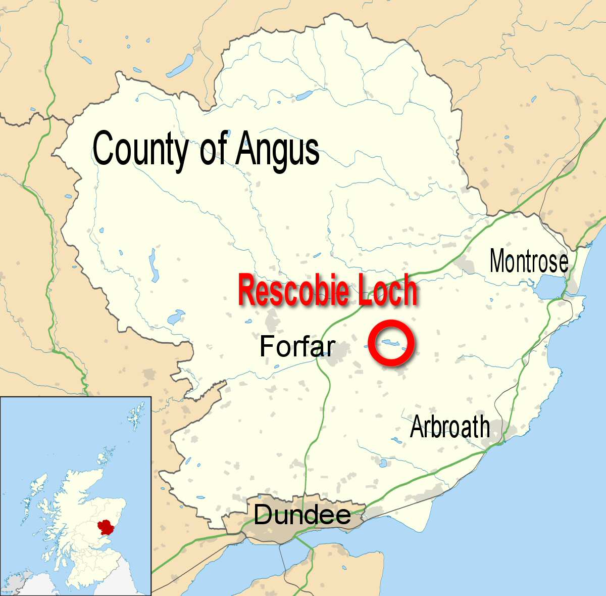
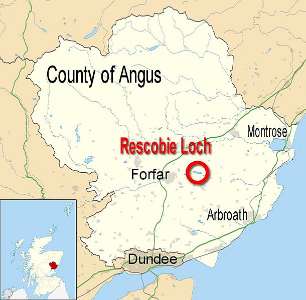
Image: Rescobie Loch Angus UK location map
Size of this preview: 610 × 599 pixels. Other resolutions: 244 × 240 pixels | 1,200 × 1,179 pixels.
Original image (1,200 × 1,179 pixels, file size: 103 KB, MIME type: image/jpeg)
Description: Blank map of Angus, UK with the following information shown: *Administrative borders *Coastline, lakes and rivers *Roads and railways *Urban areas Equirectangular map projection on WGS 84 datum, with N/S stretched 180% Geographic limits: *West: 3.5W *East: 2.4W *North: 57.0N *South: 56.4N
Title: Rescobie Loch Angus UK location map
Credit: Angus_UK_location_map.svg
Author: Angus_UK_location_map.svg: Nilfanion, created using Ordnance Survey data derivative work: Kevan Dickin (talk)
Usage Terms: Creative Commons Attribution-Share Alike 3.0
License: CC BY-SA 3.0
License Link: https://creativecommons.org/licenses/by-sa/3.0
Attribution Required?: Yes
Image usage
The following page links to this image:

All content from Kiddle encyclopedia articles (including the article images and facts) can be freely used under Attribution-ShareAlike license, unless stated otherwise.