
Image: Reserva Nacional de Paracas topographic map-es
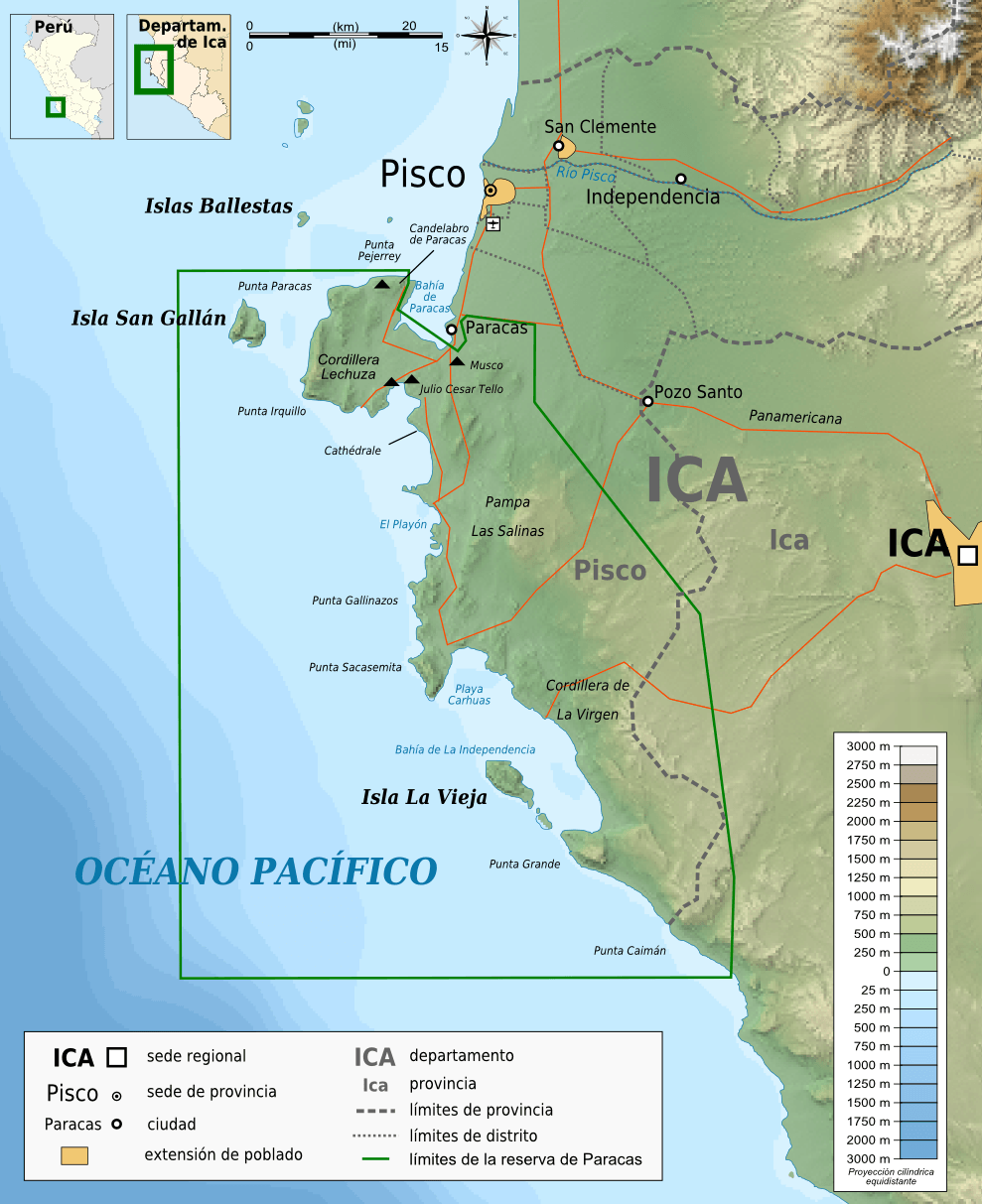
Description: Topographic map in Spanish of the Paracas National Reservation
Title: Reserva Nacional de Paracas topographic map-es
Credit: Own work ; Topographic data from the NASA Shuttle Radar Topography Mission (SRTM3 v.2) (public domain) edited with 3DEM ; equirectangular projection ; WGS84 datum ; Borders, coast, rivers : NGDC GSHHS (Global Self-consistent, Hierarchical, High-resolution Shoreline Database) / World data bank II + http://www.areasprotegidasperu.com/RNP/RNP.htm Bathymetry : NGDC ETOPO1 edited with Global Mapper 9 (dlgv32pro limited edition), de l'United States Geological Survey (USGS); Cities, roads : http://www.areasprotegidasperu.com/RNP/RNP.htm ; Scale symbol : Image:Scale_kilometres_miles_svg.svg de Sémhur, under "Public domain" Locator map from File:Peru - (Template).svg by User:Huhsunqu + File:Location of the province Pisco in Ica.svg by AgainErick Others symbols from File:Maps template-fr.svg
Author: Bourrichon - fr:Bourrichon
Permission: You may select the license of your choice.
Usage Terms: Creative Commons Attribution-Share Alike 3.0
License: CC BY-SA 3.0
License Link: https://creativecommons.org/licenses/by-sa/3.0
Attribution Required?: Yes
Image usage
The following page links to this image:
