
Image: Rheinbund 1806, political map
Size of this preview: 507 × 599 pixels. Other resolutions: 203 × 240 pixels | 2,414 × 2,854 pixels.
Original image (2,414 × 2,854 pixels, file size: 1.38 MB, MIME type: image/png)
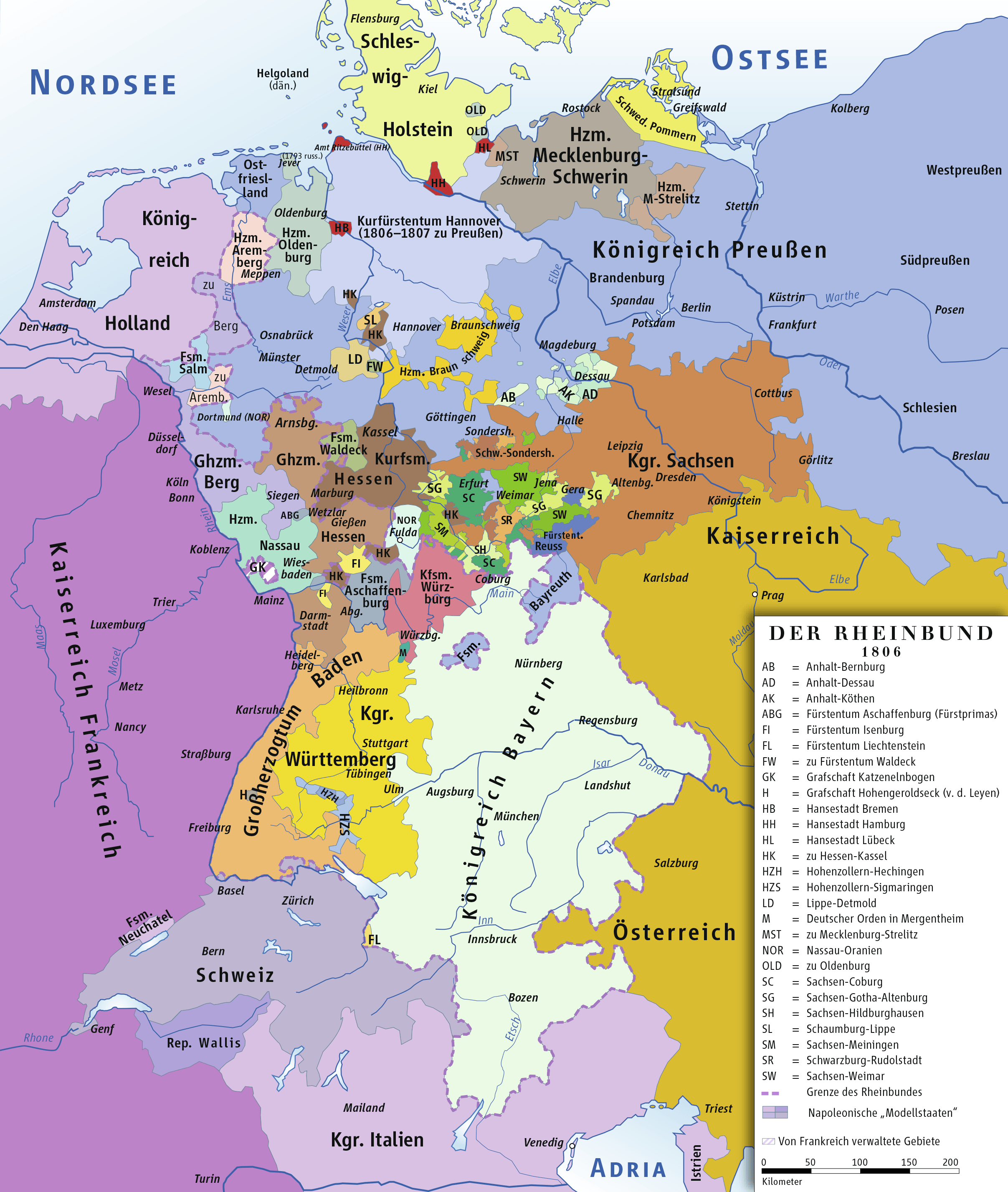
Description: Karte des Rheinbundes 1806/Map of Confederation of the Rhine 1806
Title: Rheinbund 1806, political map
Credit: own drawing/Source of Information: Putzger – Historischer Weltatlas, 89. Auflage, 1965; Westermanns Großer Atlas zur Weltgeschichte, 1969; Haacks geographischer Atlas. VEB Hermann Haack Geographisch-Kartographische Anstalt, Gotha/Leipzig, 1. Auflage, 1979.
Author: ziegelbrenner
Permission: GNU FDL
Usage Terms: Creative Commons Attribution 2.5
License: CC BY 2.5
License Link: http://creativecommons.org/licenses/by/2.5
Attribution Required?: Yes
Image usage
The following 2 pages link to this image:

All content from Kiddle encyclopedia articles (including the article images and facts) can be freely used under Attribution-ShareAlike license, unless stated otherwise.