
Image: Rock Elm crater N10NAPPW05490016
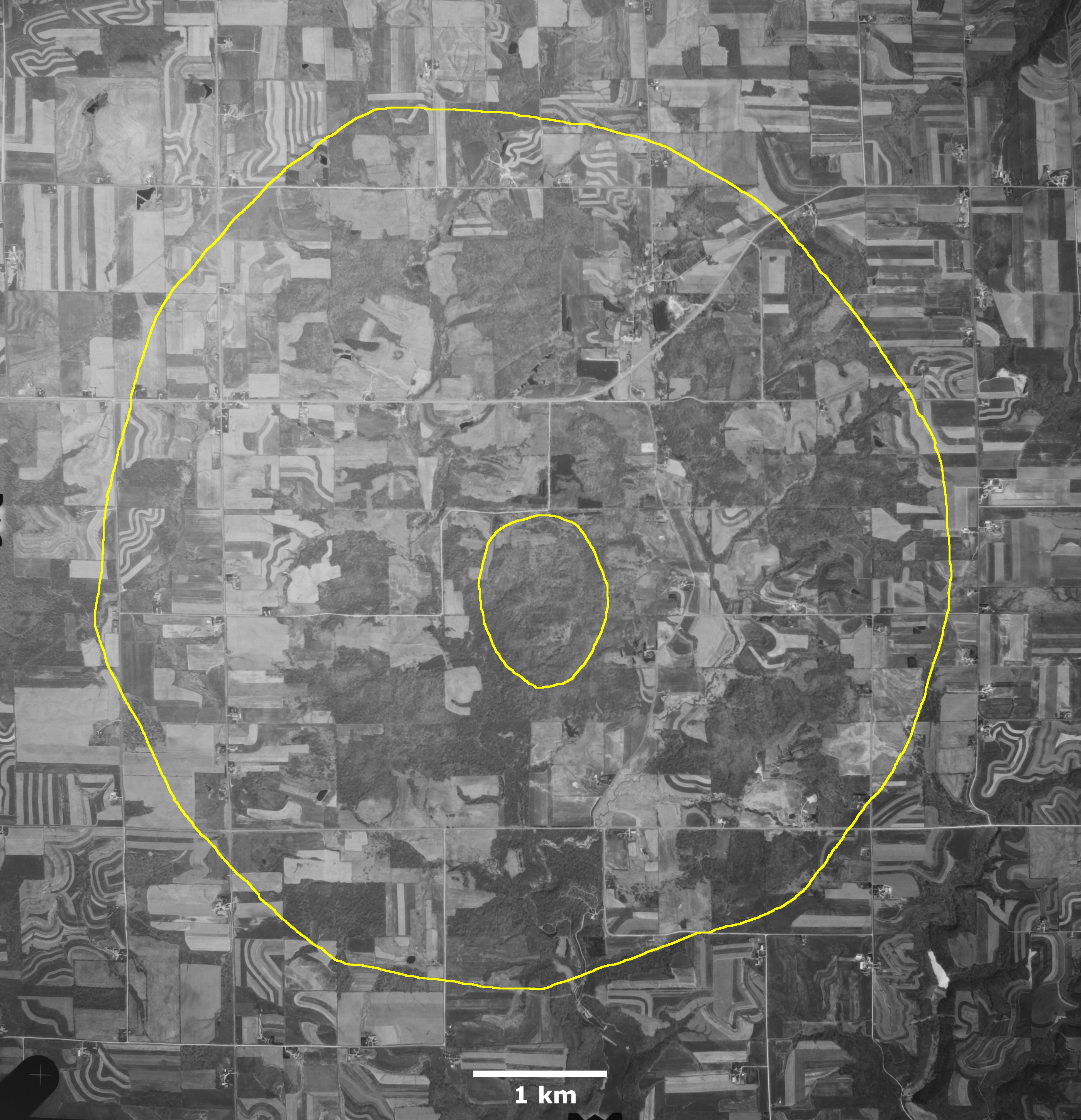
Description: The extent of Rock Elm crater as mapped by William S. Cordua, Department of Plant and Earth Science, University of Wisconsin-River Falls, in Figure 2 of publication The Rock Elm Disturbance, Pierce County, Wisconsin in FIELD TRIP GUIDEBOOK FOR THE UPPER MISSISSIPPI VALLEY, MINNESOTA, IOWA, AND WISCONSIN. Edited by N.H. Balaban. Prepared for the 21st Annual Meeting of the Geological Society of America, North-Central Section, St. Paul, Minnesota, 1987. Air photo N10NAPPW05490016, dated 7 May 1992, downloaded from USGS using EarthExplorer. Outer yellow line is approximate crater rim, and inner line is central uplift.
Title: Rock Elm crater N10NAPPW05490016
Credit: Own work
Author: Jstuby
Usage Terms: Creative Commons Zero, Public Domain Dedication
License: CC0
License Link: http://creativecommons.org/publicdomain/zero/1.0/deed.en
Attribution Required?: No
Image usage
The following page links to this image:
