
Image: Rocky Face Ridge Battlefield Georgia
Size of this preview: 456 × 599 pixels. Other resolutions: 183 × 240 pixels | 1,560 × 2,050 pixels.
Original image (1,560 × 2,050 pixels, file size: 1.27 MB, MIME type: image/jpeg)
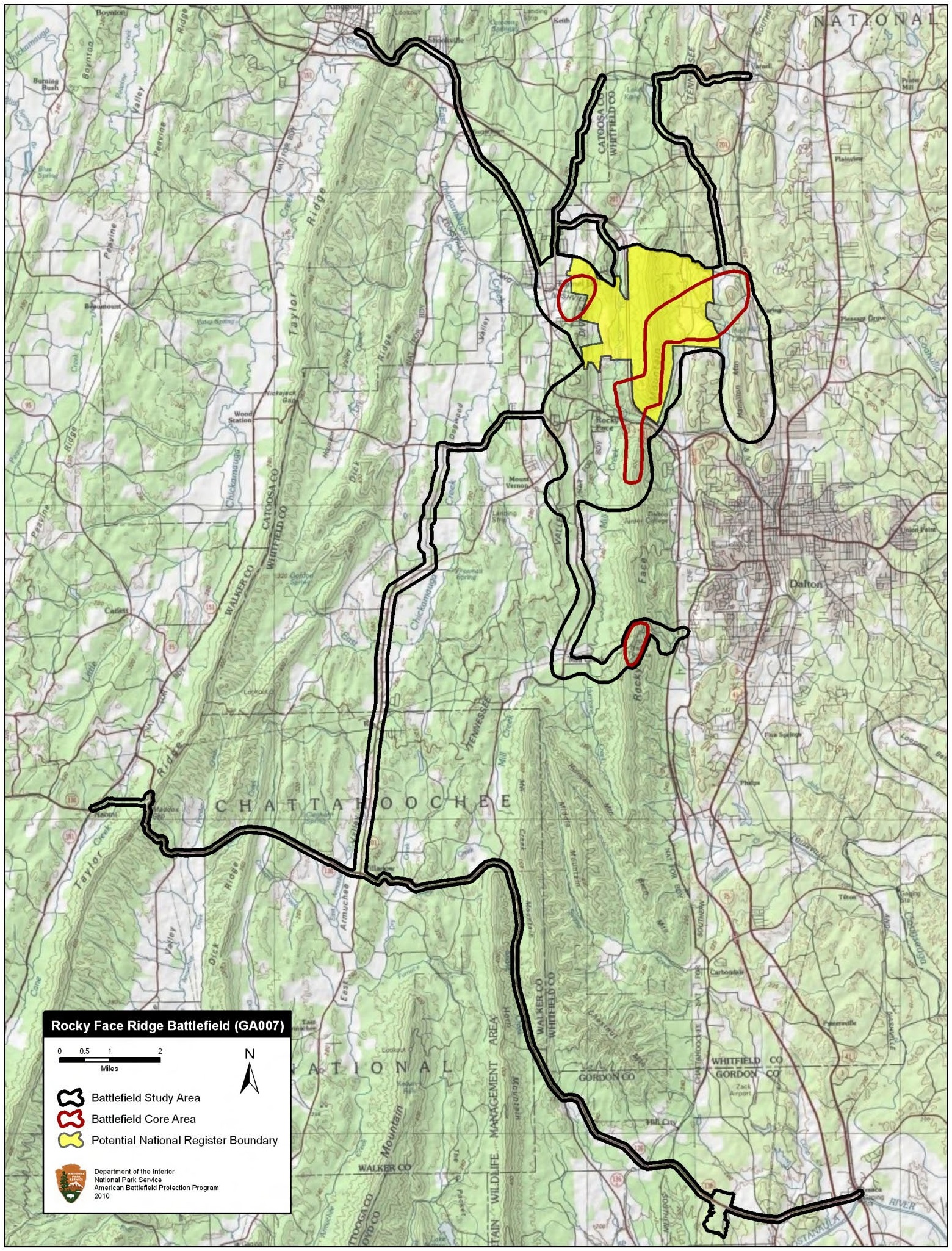
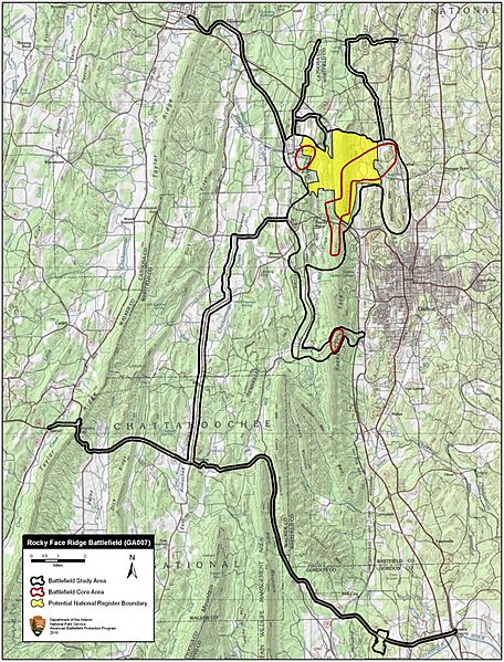
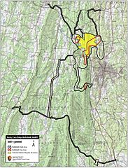
Description: Map of battlefield core and study areas. The ABPP revised the Study Area to include Federal approach routes in order to show the extent of the Federal armies’ maneuvers as they attempted to out-flank the Confederate position at Rocky Face Ridge. The Core Area has been extended south from Mill Creek Gap to include engaged Confederate infantry and artillery positions.
Title: Rocky Face Ridge Battlefield Georgia
Credit: National Park Service
Author: American Battlefield Protection Program
Usage Terms: Public domain
License: Public domain
Attribution Required?: No
Image usage
The following page links to this image:

All content from Kiddle encyclopedia articles (including the article images and facts) can be freely used under Attribution-ShareAlike license, unless stated otherwise.