
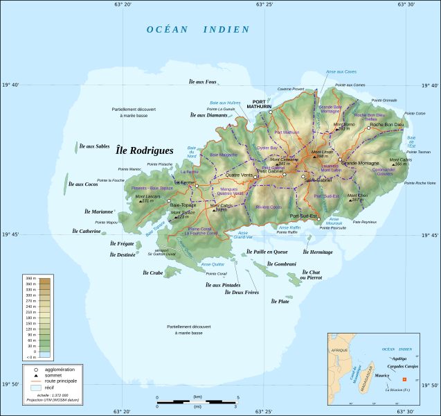
Image: Rodrigues Island topographic-zones map-fr

Size of this PNG preview of this SVG file: 637 × 600 pixels. Other resolution: 255 × 240 pixels.
Original image (SVG file, nominally 1,700 × 1,600 pixels, file size: 970 KB)
Description: Topographic map in French of Rodrigues Island, Mauritius Scale : 1:372,000 (accuracy : about 93 m) ; Printing size : 7.79 x 7.33 cm ; Note : The background map is a raster image embedded in the SVG file.
Title: Rodrigues Island topographic-zones map-fr
Credit: Rodrigues_Zonenkarte_de.png Rodrigues_Island_topographic_map-fr.svg
Author: Rodrigues_Zonenkarte_de.png: Vuxi Rodrigues_Island_topographic_map-fr.svg: Eric Gaba (Sting - fr:Sting) derivative work: M0tty (talk)
Usage Terms: Creative Commons Attribution-Share Alike 3.0
License: CC BY-SA 3.0
License Link: https://creativecommons.org/licenses/by-sa/3.0
Attribution Required?: Yes
Image usage
There are no pages that link to this image.

All content from Kiddle encyclopedia articles (including the article images and facts) can be freely used under Attribution-ShareAlike license, unless stated otherwise.