
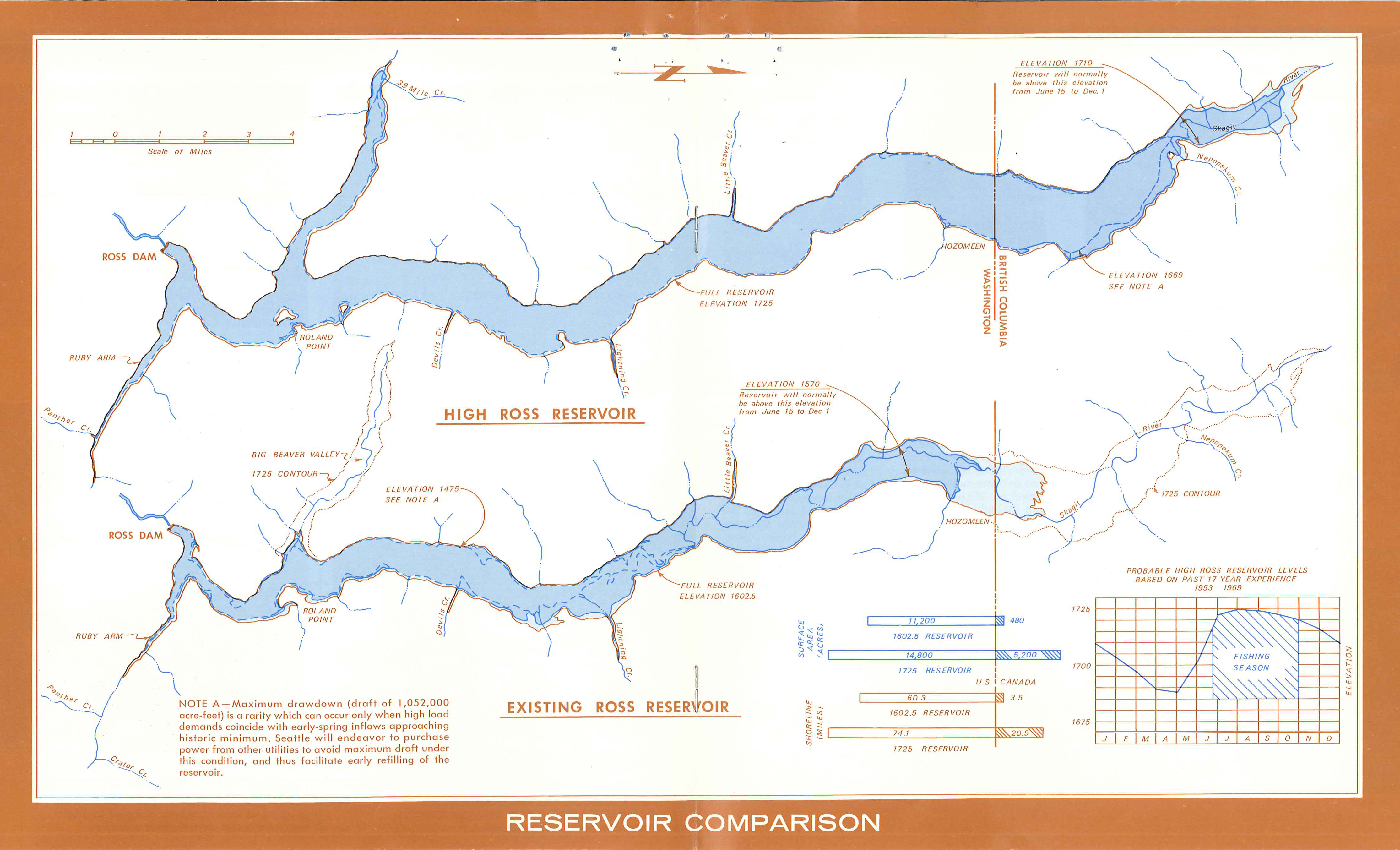
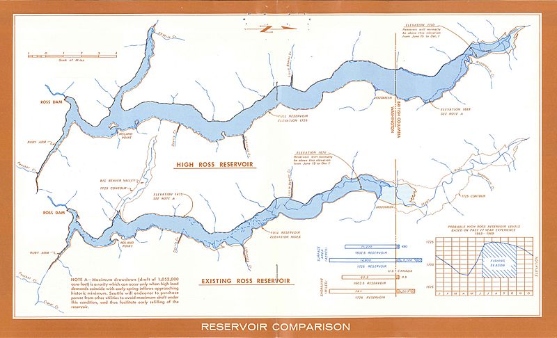
Image: Ross High Dam comparison
Size of this preview: 800 × 486 pixels. Other resolutions: 320 × 194 pixels | 4,458 × 2,706 pixels.
Original image (4,458 × 2,706 pixels, file size: 3.78 MB, MIME type: image/jpeg)
Description: Pair of maps showing comparison of lake size if the 4th stage "high dam" at Ross Dam had been built. This is an official Seattle City Light map from when the proposal was still active in 1970.
Title: Ross High Dam comparison
Credit: Seattle Municipal Archives
Author: Seattle Municipal Archives from Seattle, WA
Usage Terms: Creative Commons Attribution 2.0
License: CC BY 2.0
License Link: https://creativecommons.org/licenses/by/2.0
Attribution Required?: Yes
Image usage
The following page links to this image:

All content from Kiddle encyclopedia articles (including the article images and facts) can be freely used under Attribution-ShareAlike license, unless stated otherwise.