
Image: SDBayAreaNASA
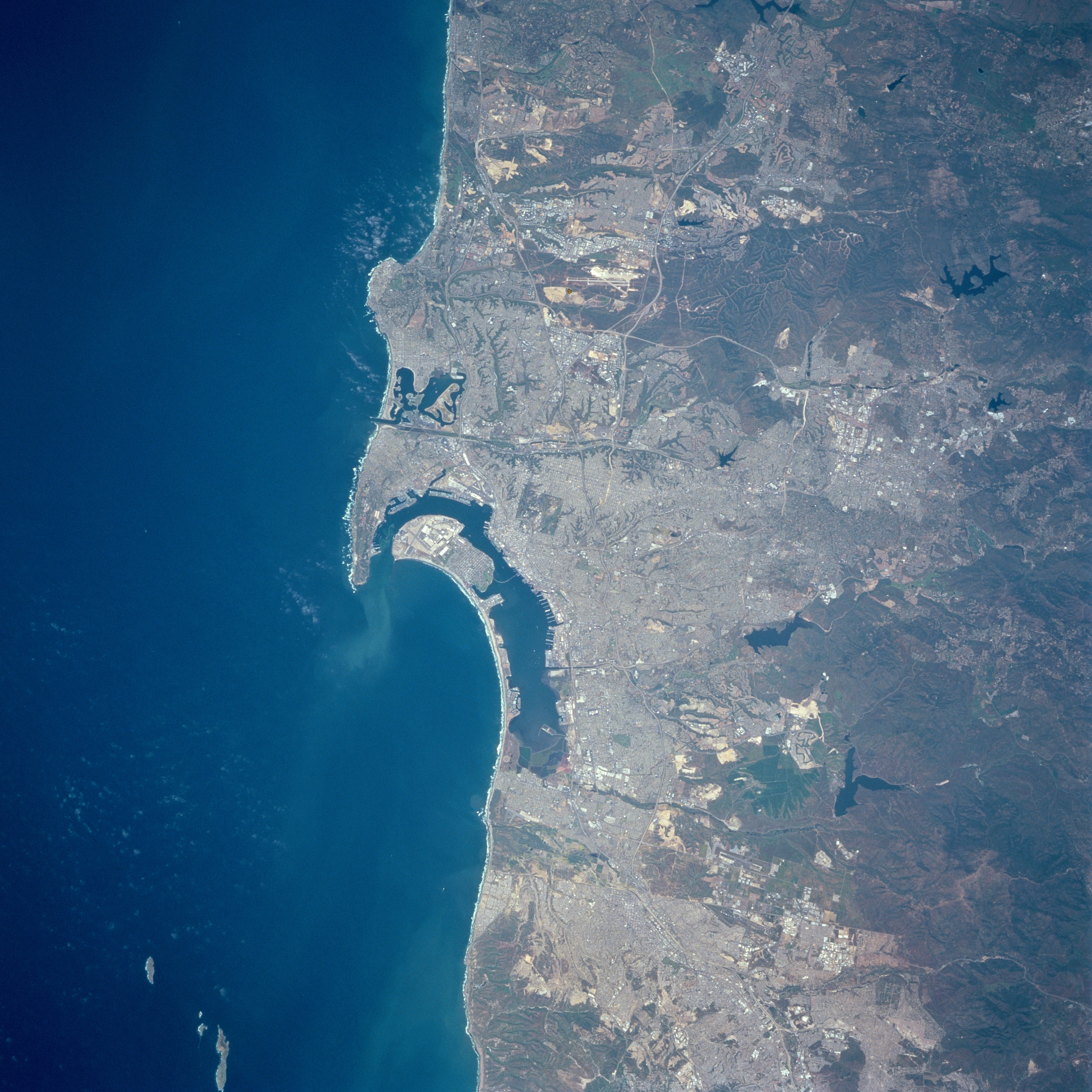
Description: Three major features dominate this image of the southwest coast of California: the deep blue (dark) waters of the Pacific Ocean; the highly reflective, man-made urban and suburban environment along the coast; and the rugged, natural terrain of low mountain foothills of the Peninsular Ranges east of the urban development. The greater metropolitan area of San Diego (CA) and Tijuana (Mexico) with a combined population of approximately four million people can be identified as the lighter colored, highly reflective area on the image. Several types of infrastructure associated with the developed urban area are visible on this small-scale image. Reservoirs, including the lower Otay, Sweetwater, and St. Vicente Reservoirs, are the irregularly shaped, dark blue areas. The light-colored linear runways of Miramar Naval Air Station lie north of the densely populated area of San Diego. Interstate Highways 5 and 15 (light colored, linear features) radiate northward away from San Diego. The small square-shaped features along the edges of the bay are the many piers that jut into San Diego Bay. Mission Bay Harbor and Marina (dark area) is found along the coast north of the entrance to San Diego Bay.
Title: SDBayAreaNASA
Credit: Image courtesy of Earth Sciences and Image Analysis Laboratory, NASA Johnson Space Center: NASA photo STS090-758-17 (mission STS090, roll 758, frame 17); high-resolution version from ftp://eol.jsc.nasa.gov/EFS_highres_STS090_STS090-758-17.JPG
Author: NASA
Usage Terms: Public domain
License: Public domain
Attribution Required?: No
Image usage
The following page links to this image:
