
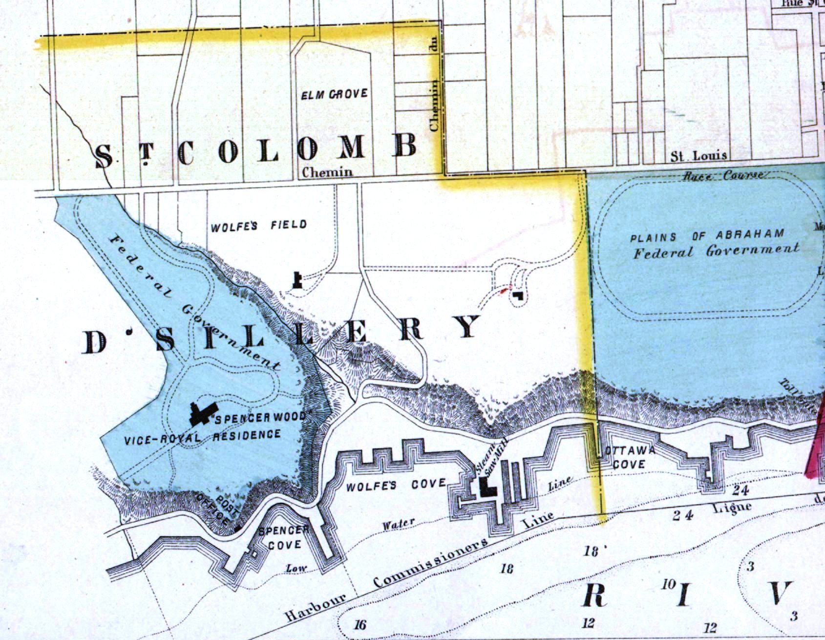
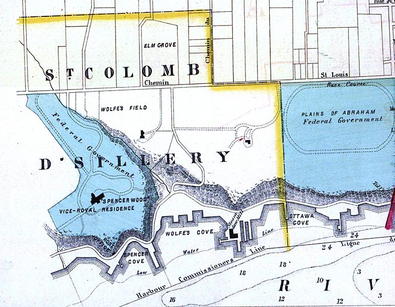
Image: Saint-Colomb-de-Sillery in Atlas of the city and county of Quebec from actual surveys, based upon the cadastral plans deposited in the office of the Department of Crown Lands (cropped)
Size of this preview: 773 × 600 pixels. Other resolutions: 310 × 240 pixels | 1,689 × 1,310 pixels.
Original image (1,689 × 1,310 pixels, file size: 443 KB, MIME type: image/jpeg)
Description: Atlas of the city and county of Quebec from actual surveys, based upon the cadastral plans deposited in the office of the Department of Crown Lands
Title: Saint-Colomb-de-Sillery in Atlas of the city and county of Quebec from actual surveys, based upon the cadastral plans deposited in the office of the Department of Crown Lands (cropped)
Credit: This image is available from Bibliothèque et Archives nationales du Québec under the reference number 2244119
Author: Henry Whitmer Hopkins
Usage Terms: Public domain
License: Public domain
Attribution Required?: No
Image usage
The following page links to this image:

All content from Kiddle encyclopedia articles (including the article images and facts) can be freely used under Attribution-ShareAlike license, unless stated otherwise.
.jpg)