
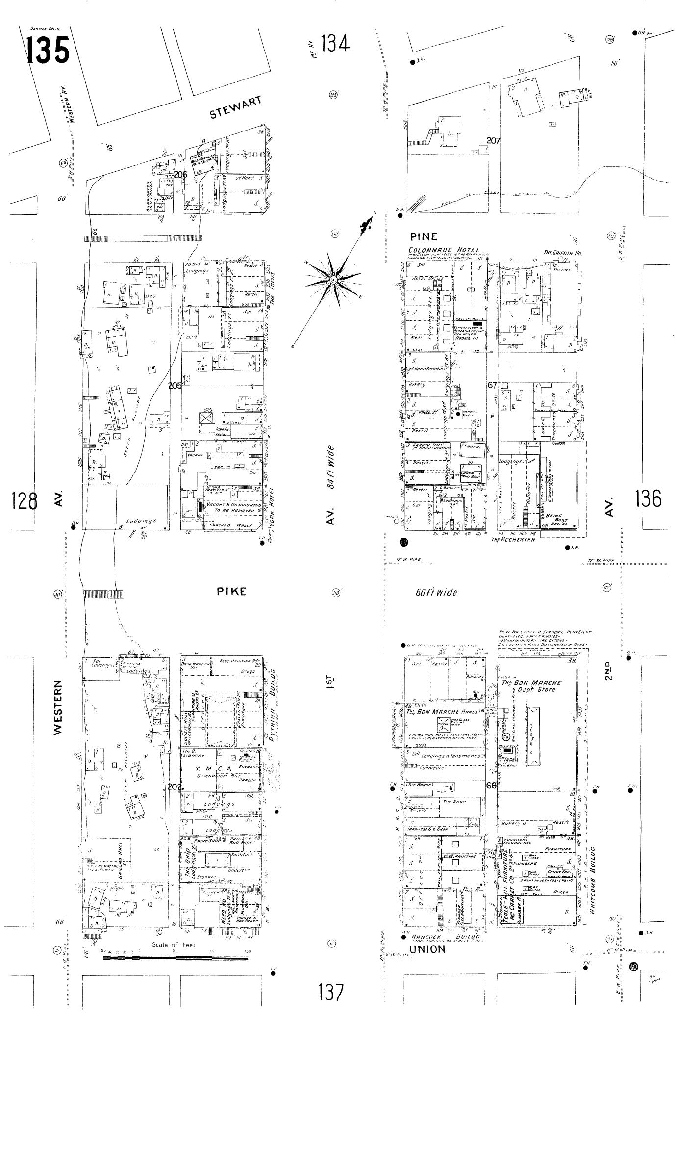
Image: Sanborn Seattle 1904-1905 map 135
Description: 1905 map of part of Seattle, Washington. The map extends from Western Avenue northeast to Second Avenue and from Union Street northwest roughly to Stewart Street. The left half of what is visible here now falls within the city-designated Pike Place Market Historical District. The remainder is the part of the downtown core.
Title: Sanborn Seattle 1904-1905 map 135
Credit: Map 135, Insurance Maps of Seattle, Volume Two, Sanborn Map Company, 11 Broadway, New York, reproduced on the "Digital Sanborn Maps 1867-1970" online (subscription) database
Author: Pacific Dept Sanborn Map Company (San Francisco)
Permission: PD-US
Usage Terms: Public domain
License: Public domain
Attribution Required?: No
Image usage
The following page links to this image:
