
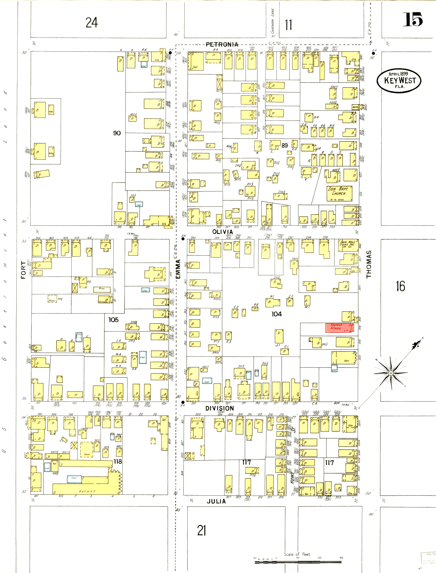
Image: Sanborn fire map for Key West, sheet 15
Size of this preview: 456 × 599 pixels. Other resolutions: 183 × 240 pixels | 1,443 × 1,896 pixels.
Original image (1,443 × 1,896 pixels, file size: 521 KB, MIME type: image/png)
Description: Sanborn fire map for Key West, sheet 15
Title: Sanborn fire map for Key West, sheet 15
Credit: https://www.loc.gov/resource/g3934km.g3934km_g012911899/?sp=15&st=image&r=0.004,0.364,1.287,0.593,0 (Library of Congress Sanborn fire maps)
Author: Sanborn-Perris Map Co., limited
Usage Terms: Public domain
License: Public domain
Attribution Required?: No
Image usage
The following page links to this image:

All content from Kiddle encyclopedia articles (including the article images and facts) can be freely used under Attribution-ShareAlike license, unless stated otherwise.