Image: SandyIslandBeachSP topo
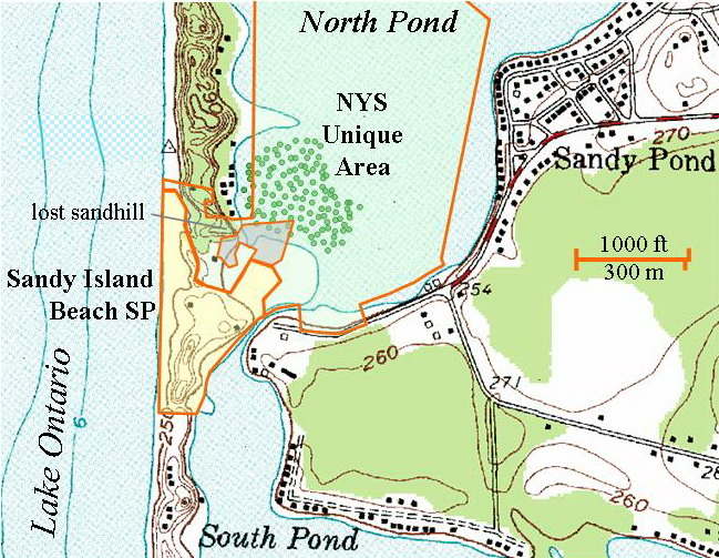
Description: Topographic map showing the boundaries of Sandy Island Beach, which is a New York State Park, and for the Sandy Island Beach Unique Area, which is a New York State Forest. Park boundaries are based on the Oswego County tax map for a parcel with tax ID 027.13-01-01, which in 2008 is listed as owned by "New York State (Sandy Island)". Unique Area boundaries are based on the parcel with tax ID 027.14-01-01.2, which in 2008 is listed as owned by the New York State Department of Environmental Conservation; this region was sold to New York by the Nature Conservancy in 2004. The shaded gray area within the boundary of the Unique Area is privately owned.
Title: SandyIslandBeachSP topo
Credit: United States Geological Survey map (Ellisburg, N.Y. quadrangle, 1958) as made available through the Libre Map Project; additional artwork by Wikipedia editor Easchiff.
Author: w:United States Geological Survey, Easchiff
Usage Terms: Creative Commons Attribution-Share Alike 3.0
License: CC BY-SA 3.0
License Link: https://creativecommons.org/licenses/by-sa/3.0
Attribution Required?: Yes
Image usage
The following page links to this image:


