
Image: Santa Ana River, Lake Norconian, Prado Flood Control Basin

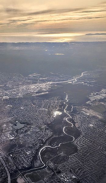
Description: Aerial view of the Santa Ana River, looking into the afternoon sun, where the river forms the boundary between Norco and Eastvale, California, and flows into the Prado Flood Control Basin. The Prado Dam is just before the intersection of California highways 91 and 71 at the far side of the dark flood-control reservoir. The Pacific Ocean and Santa Catalina Island are visible in the distance. On the left, Lake Norconian at the Naval Sea Systems Command near Norco College is visible.
Title: Santa Ana River, Lake Norconian, Prado Flood Control Basin
Credit: Own work
Author: Dicklyon
Usage Terms: Creative Commons Attribution-Share Alike 4.0
License: CC BY-SA 4.0
License Link: https://creativecommons.org/licenses/by-sa/4.0
Attribution Required?: Yes
Image usage
The following page links to this image:
