
Image: Sarasota McClellan Park map 83d40m developed by Katherine and Daisietta McClellan 1913

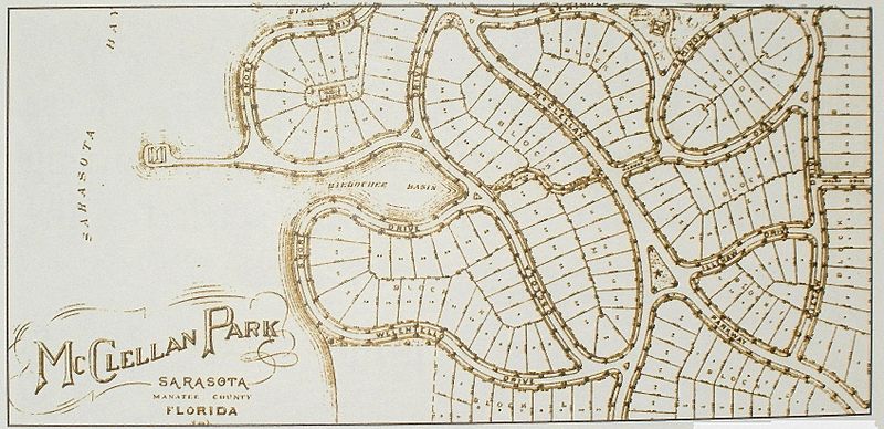
Description: Category:Sarasota photograph of a historic map of McClellan Park - a bay front subdivision south of the urban center of Sarasota, Florida developed in 1913 by two sisters, Katherine McClellan and Daisietta McClellan, whose design had a yacht basin, a clubhouse with facilities for a large central automobile garage, tennis courts, and a clock golf course; the novel design deviated from the typical grid used in many plats and created a charming community that only recently, during the boom period of the 1990s-2000s, had been invaded by speculative development that tore down charming original, still-functional and often, historic homes to erect structures out of proportion to the original scale of the community that loom over their neighbors -- they are nicknamed Miami Vice houses in Sarasota; collapse of the boom currently has halted the speculation; the plat is marked as Manatee County because Sarasota was part of that county in 1913; the map is from the public collection of the Sarasota County History Center, a division of the county government
Title: Sarasota McClellan Park map 83d40m developed by Katherine and Daisietta McClellan 1913
Credit: self-made
Author: 83d40m
Permission: see below
Usage Terms: Public domain in the United States
License: PD-US
License Link: //en.wikipedia.org/wiki/File:Sarasota_McClellan_Park_map_83d40m_developed_by_Katherine_and_Daisietta_McClellan_1913.jpg
Image usage
The following page links to this image:
