
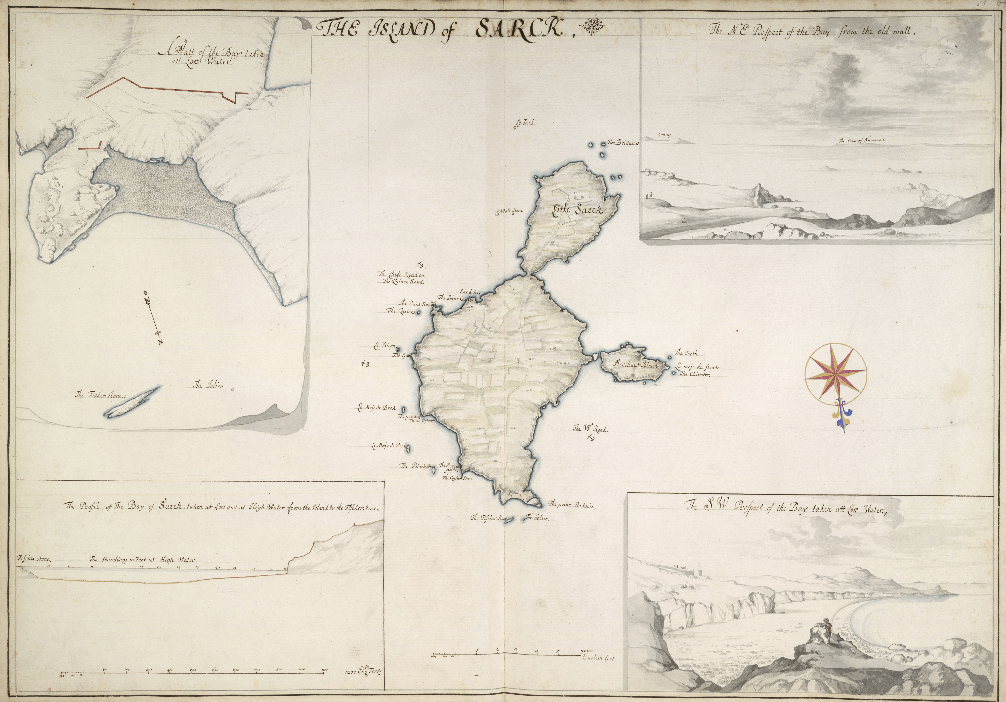
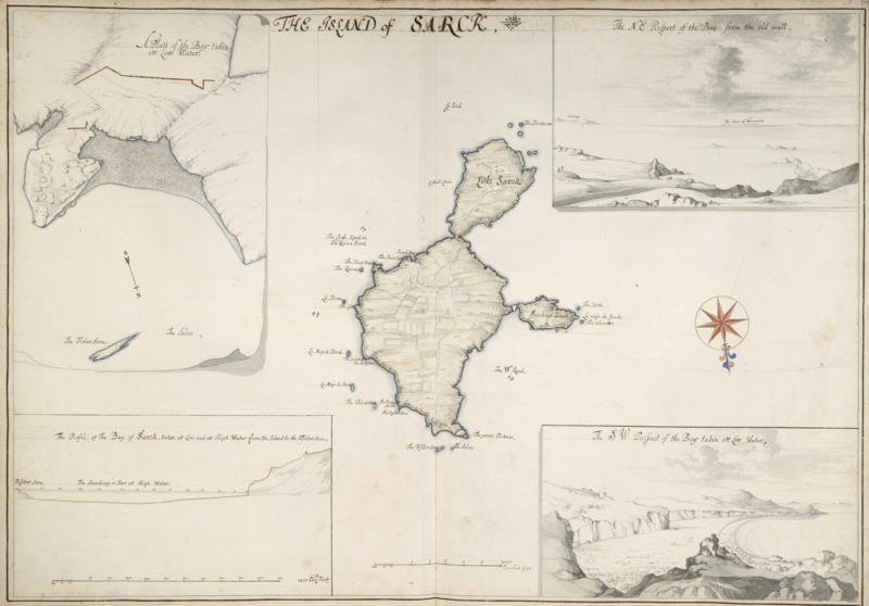
Image: Sark map 1680 by Thomas Phillips
Size of this preview: 800 × 558 pixels. Other resolutions: 320 × 223 pixels | 4,000 × 2,791 pixels.
Original image (4,000 × 2,791 pixels, file size: 16.01 MB, MIME type: image/png)
Description: map of Sark, Guernsey, Channel Islands, at scale 1:20,400, North is down, Merchant Island = Brecqhou
Title: Sark map 1680 by Thomas Phillips
Credit: http://www.bl.uk/onlinegallery/onlineex/maps/europe/zoomify53076.html
Author: Thomas Phillips
Usage Terms: Public domain
License: Public domain
Attribution Required?: No
Image usage
The following page links to this image:

All content from Kiddle encyclopedia articles (including the article images and facts) can be freely used under Attribution-ShareAlike license, unless stated otherwise.