
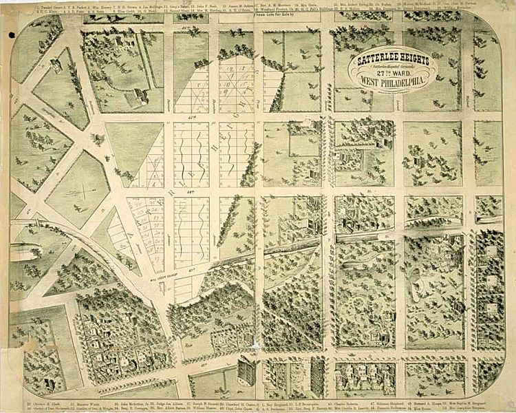
Image: Satterlee-heights

Description: An illustration of existing and proposed uses of land in West Philadelphia, produced around 1869 by real estate developers who sought to sell plots of land on the site of the Union's Satterlee Civil War hospital. Drawn with the west at the top, the map shows (at bottom left) the area that will become Clark Park. It also shows the part of Mill Creek that was then above ground; the entirety was ultimately buried. This image, now in the public domain due to its age, was originally supplied by the Library Company of Philadelphia to Matthew Grubel, who posted it as part of a work called "The Building of West Philadelphia" (http://www.archives.upenn.edu/histy/features/wphila/exhbts/grubel/index.html)
Title: Satterlee-heights
Credit: http://www.archives.upenn.edu/histy/features/wphila/exhbts/grubel/24develop2.html.
Author: Herline & Co. Lithographers [1869-70]
Usage Terms: Public domain
License: Public domain
Attribution Required?: No
Image usage
The following page links to this image:
