
Image: Scandinavia1219
Size of this preview: 513 × 600 pixels. Other resolutions: 205 × 240 pixels | 1,500 × 1,754 pixels.
Original image (1,500 × 1,754 pixels, file size: 39 KB, MIME type: image/png)
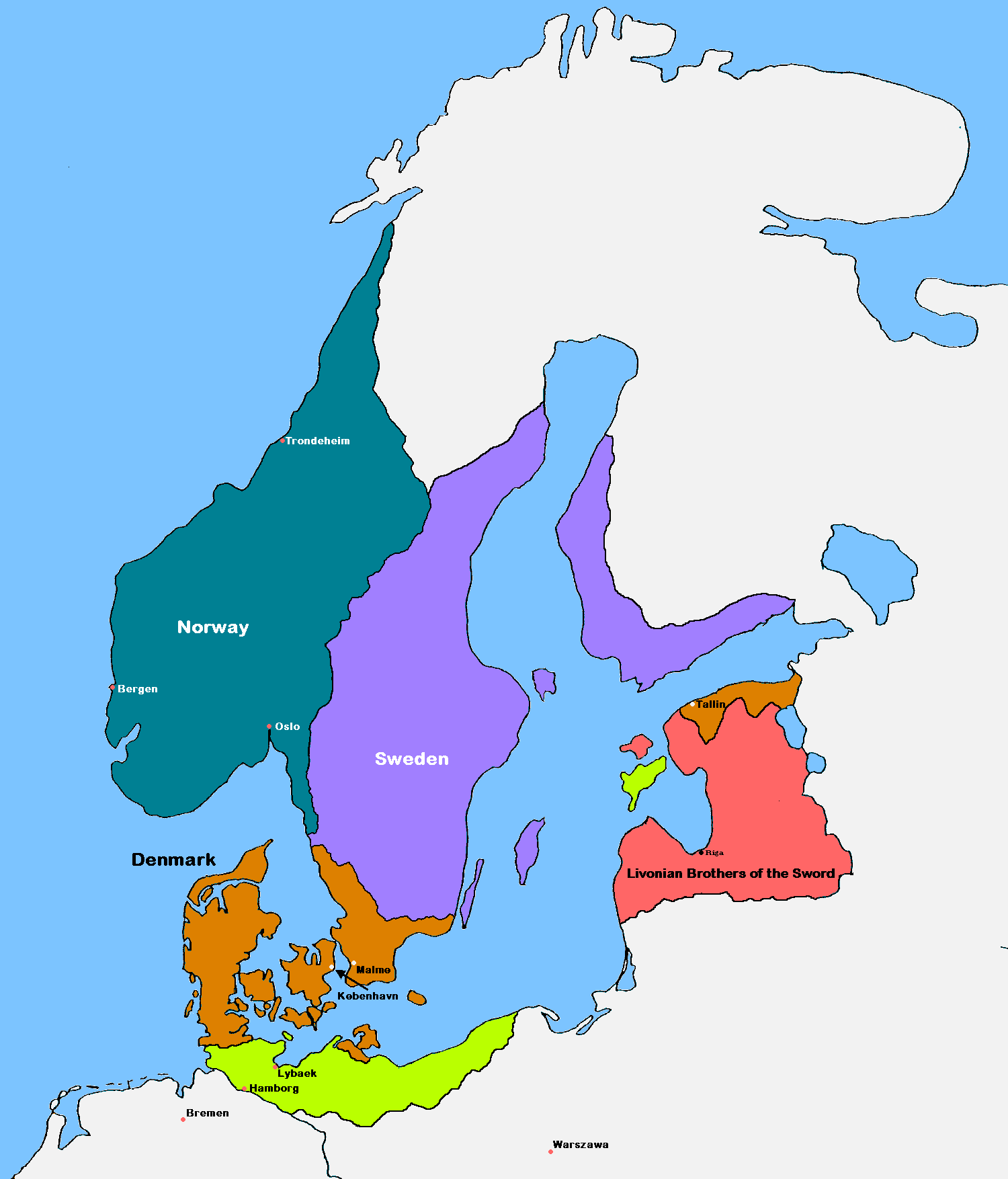
Description: Update of the historical and political map, created in 2005 by Kasper Holl. It is a compressed format, has an easier colour scheme and has greater sized labels. NB on accuracy: Sweden did not reach this size until after the 1330s, when colonialization of Västerbotten started. Swedish colonialization of Finnish coast started before 1250. Sweden lost Gotland to Denmark in 1361. Trondheim has a wrong placement on map.
Title: Scandinavia1219
Credit: Original image: File:Scandinavia in 1219.GIF
Author: MasterOfHisOwnDomain
Usage Terms: Creative Commons Attribution-Share Alike 3.0
License: CC BY-SA 3.0
License Link: http://creativecommons.org/licenses/by-sa/3.0/
Attribution Required?: Yes
Image usage
The following 3 pages link to this image:

All content from Kiddle encyclopedia articles (including the article images and facts) can be freely used under Attribution-ShareAlike license, unless stated otherwise.