
Image: SeismicAreas JapanTrenchEarthquakes
Size of this preview: 461 × 599 pixels. Other resolutions: 184 × 240 pixels | 1,000 × 1,300 pixels.
Original image (1,000 × 1,300 pixels, file size: 210 KB, MIME type: image/png)
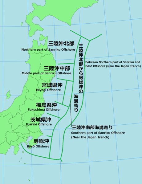
Description: 日本海溝周辺の海溝型地震における、地震調査委員会による想定震源域の地図(出典:三陸沖から房総沖にかけての地震活動の長期評価について 図1 地震調査委員会、2002年7月31日)。
Author: User:Lincun
Usage Terms: Creative Commons Attribution-Share Alike 3.0
License: CC-BY-SA-3.0
License Link: http://creativecommons.org/licenses/by-sa/3.0/
Attribution Required?: Yes
Image usage
The following page links to this image:

All content from Kiddle encyclopedia articles (including the article images and facts) can be freely used under Attribution-ShareAlike license, unless stated otherwise.