
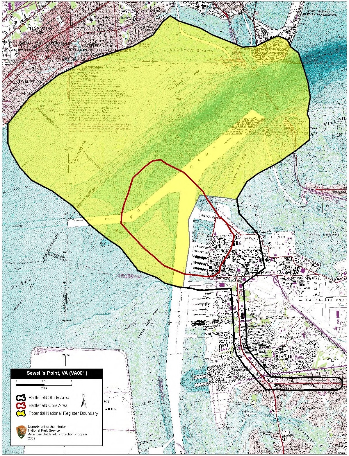
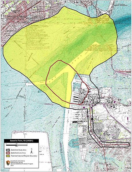
Image: Sewell's Point Battlefield Virginia
Size of this preview: 458 × 599 pixels. Other resolutions: 183 × 240 pixels | 1,200 × 1,570 pixels.
Original image (1,200 × 1,570 pixels, file size: 1.36 MB, MIME type: image/jpeg)
Description: Map of battlefield core and study areas. The revised Study Area includes the Union base of operations at Fort Monroe, shipping lanes, areas of maneuver for the Union gunboats, and the route used to supply the Confederate batteries on Sewell’s Point.
Title: Sewell's Point Battlefield Virginia
Credit: National Park Service
Author: American Battlefield Protection Program
Usage Terms: Public domain
License: Public domain
Attribution Required?: No
Image usage
The following page links to this image:

All content from Kiddle encyclopedia articles (including the article images and facts) can be freely used under Attribution-ShareAlike license, unless stated otherwise.