
Image: Siberian Khanate map English revised

Size of this PNG preview of this SVG file: 799 × 599 pixels. Other resolution: 320 × 240 pixels.
Original image (SVG file, nominally 2,403 × 1,803 pixels, file size: 89 KB)
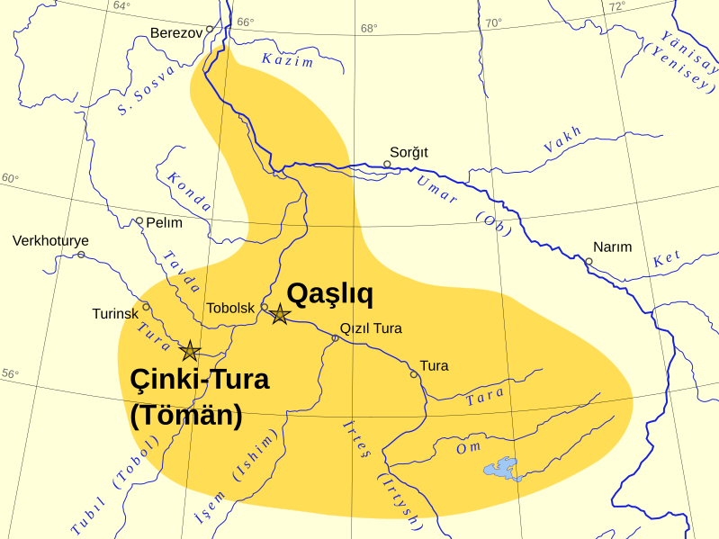
Description: Approximate extent of the Khanate of Sibir in the fifteenth-sixteenth centuries. Revised version of File:Siberian Khanate map English.svg. Based on the map "Russian state in the XVI - early XVII centuries (1490-1618)" in World History, Volume IV, Moscow: Soviet Academy of Sciences, 1958.
Title: Siberian Khanate map English revised
Credit: Own work
Author: Ro4444
Usage Terms: Creative Commons Attribution-Share Alike 4.0
License: CC BY-SA 4.0
License Link: https://creativecommons.org/licenses/by-sa/4.0
Attribution Required?: Yes
Image usage
The following page links to this image:

All content from Kiddle encyclopedia articles (including the article images and facts) can be freely used under Attribution-ShareAlike license, unless stated otherwise.