
Image: Sicily prehellenic topographic map

Size of this PNG preview of this SVG file: 800 × 533 pixels. Other resolution: 320 × 213 pixels.
Original image (SVG file, nominally 2,373 × 1,582 pixels, file size: 3.55 MB)
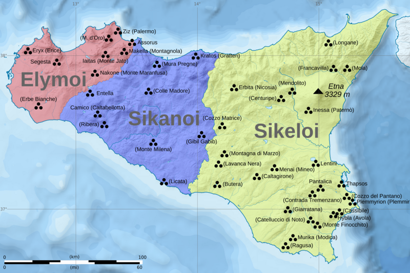
Description: The map shows the most important archaeological sites of Sicily related to pre-hellenic cultures, as well as the possible extent of the cultures of Sicani, Siceli and Elymians. Note that the borders shown are merely approximate, and resemble the situation of VI century BC, when there already were foreign colonies present on the island. Historical names where known, modern Italian names in brackets.
Title: Sicily prehellenic topographic map
Credit: Own work
Author: Halibutt
Usage Terms: Creative Commons Attribution-Share Alike 4.0
License: CC BY-SA 4.0
License Link: https://creativecommons.org/licenses/by-sa/4.0
Attribution Required?: Yes
Image usage
The following page links to this image:

All content from Kiddle encyclopedia articles (including the article images and facts) can be freely used under Attribution-ShareAlike license, unless stated otherwise.