
Image: SiegeOfQuebec1759ByDesBarres
Size of this preview: 800 × 386 pixels. Other resolutions: 320 × 154 pixels | 6,854 × 3,304 pixels.
Original image (6,854 × 3,304 pixels, file size: 8.58 MB, MIME type: image/jpeg)
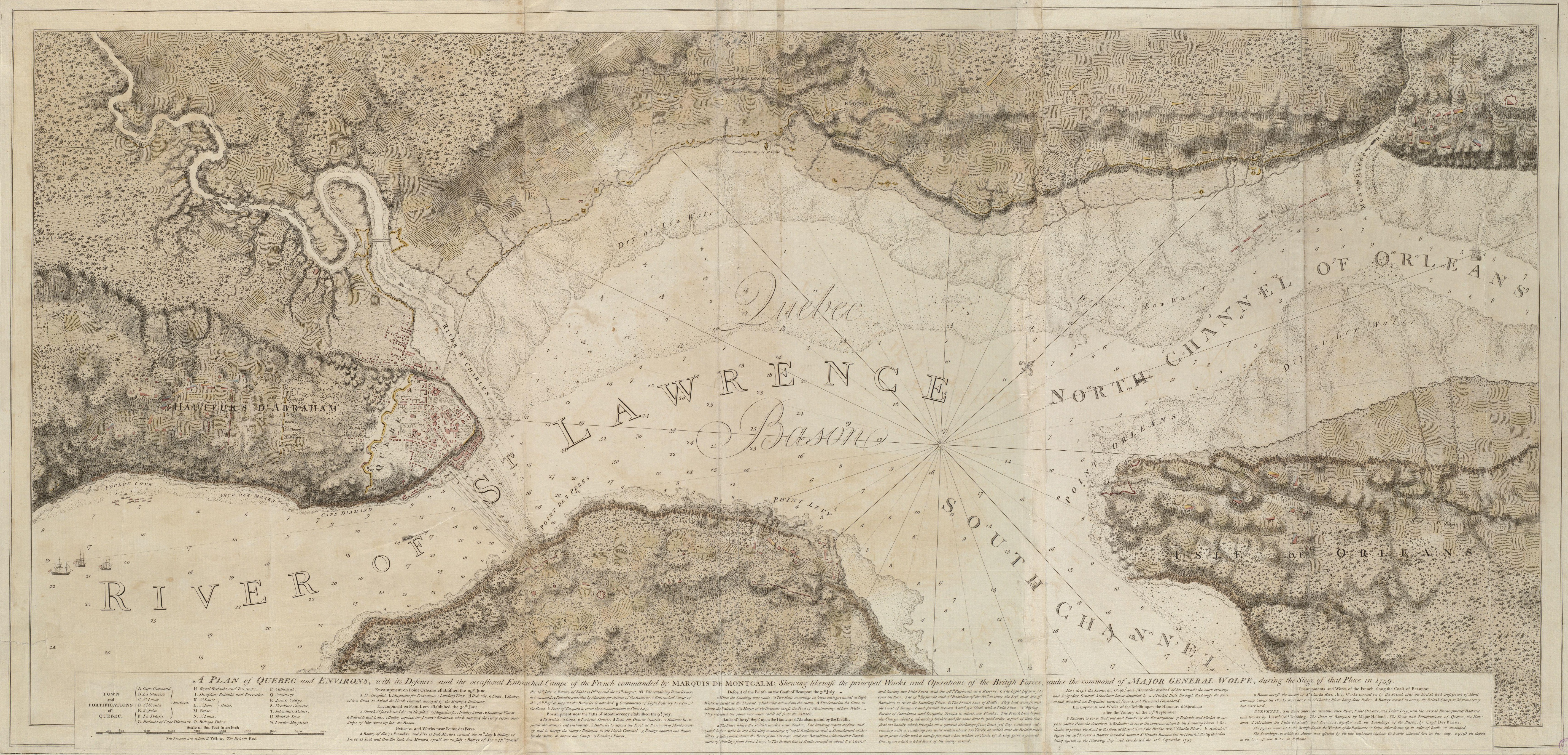
Description: This is a map depicting the troop arrangements at the 1759 Siege of Quebec. The caption reads: A Plan of Quebec and Environs, with its Defenses and the occasional entrenched Camps of the French commanded by Marquis de Montcalme; shewing likewise the principal Works and Operations of the British Forces, under the command of Major General Wolfe, during the Siege of that Place in 1759.
Title: SiegeOfQuebec1759ByDesBarres
Credit: Boston Public Library Digital Maps Collection Call Number: G1106.P5 1777 .D4
Author: Joseph F. W. Des Barres
Usage Terms: Public domain
License: Public domain
Attribution Required?: No
Image usage
The following page links to this image:

All content from Kiddle encyclopedia articles (including the article images and facts) can be freely used under Attribution-ShareAlike license, unless stated otherwise.