
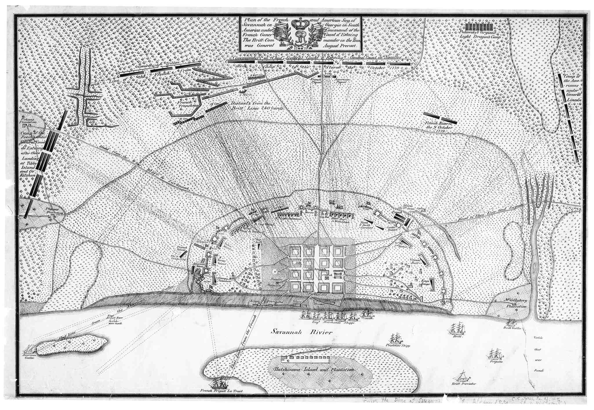
Image: Siege ville de Savannah 1779
Size of this preview: 800 × 552 pixels. Other resolutions: 320 × 221 pixels | 2,049 × 1,415 pixels.
Original image (2,049 × 1,415 pixels, file size: 421 KB, MIME type: image/jpeg)
Description: Map of the siege of Savannah by French and Americans in 1779. Map of 1874 made after a plan period.
Title: Siege ville de Savannah 1779
Credit: Archives américaines, Université de Géorgie.
Author: Jones
Usage Terms: Public domain
License: Public domain
Attribution Required?: No
Image usage
The following page links to this image:

All content from Kiddle encyclopedia articles (including the article images and facts) can be freely used under Attribution-ShareAlike license, unless stated otherwise.