
Image: Simon's Bluff Battlefield South Carolina
Size of this preview: 464 × 600 pixels. Other resolutions: 186 × 240 pixels | 1,470 × 1,900 pixels.
Original image (1,470 × 1,900 pixels, file size: 869 KB, MIME type: image/jpeg)
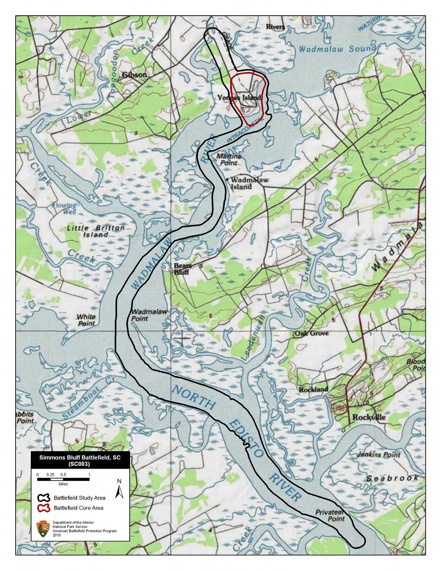
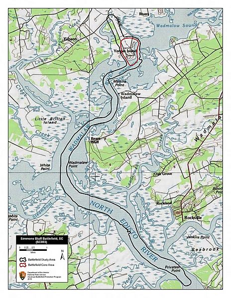
Description: Map of battlefield core and study areas. The ABPP extended the 1993 Study Area down the Wadmalaw and North Edisto Rivers to represents the US approach from the South Atlantic Blockading Squadron’s position to Simmon’s Bluff and the withdrawal of US forces back to the squadron after the raid. The expanded Core Area now includes the angles of fire from US gunboats in the Wadmalaw River.
Title: Simon's Bluff Battlefield South Carolina
Credit: National Park Service
Author: American Battlefield Protection Program
Usage Terms: Public domain
License: Public domain
Attribution Required?: No
Image usage
The following page links to this image:

All content from Kiddle encyclopedia articles (including the article images and facts) can be freely used under Attribution-ShareAlike license, unless stated otherwise.