
Image: Snetterton 1974 annotated

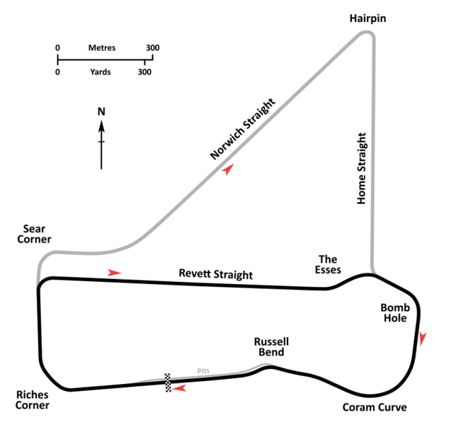
Description: An annotated diagrammatic map of the Snetterton Circuit as it was configured in 1974, immediately following the work undertaken to create Revett Straight, to shorten the circuit by bypassing the northern portion. The little-used but still accessible old long circuit straights are shown in grey. The new Esses complex is depicted in its original, open, sweeping configuration. Following a number of accidents through the 1974 season, this section was revised prior to the start of the 1975 season. Circuit cartography is derived from satellite imagery available from internet mapping services and contemporary Ordnance Survey plans. Circuit layout and corner names are per diagrams printed in contemporary race programs.
Title: Snetterton 1974 annotated
Credit: Own work
Author: John Chapman
Usage Terms: Creative Commons Attribution-Share Alike 4.0
License: CC BY-SA 4.0
License Link: https://creativecommons.org/licenses/by-sa/4.0
Attribution Required?: Yes
Image usage
The following page links to this image:
