
Image: Snetterton 1977 annotated

Size of this PNG preview of this SVG file: 647 × 600 pixels. Other resolution: 259 × 240 pixels.
Original image (SVG file, nominally 794 × 736 pixels, file size: 593 KB)
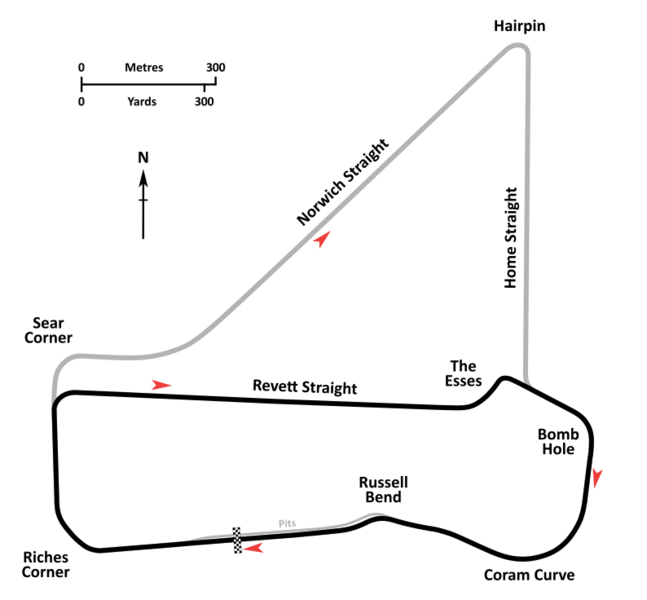
Description: An annotated diagrammatic map of the Snetterton Circuit as it was configured circa 1977, prior to the relocation and tightening of the Russell corner. The little-used but still accessible old long circuit straights are shown in grey. Circuit cartography is derived from satellite imagery available from internet mapping services and contemporary Ordnance Survey plans. Circuit layout and corner names are per diagrams printed in contemporary race programs.
Title: Snetterton 1977 annotated
Credit: Own work
Author: John Chapman
Usage Terms: Creative Commons Attribution-Share Alike 4.0
License: CC BY-SA 4.0
License Link: https://creativecommons.org/licenses/by-sa/4.0
Attribution Required?: Yes
Image usage
The following page links to this image:

All content from Kiddle encyclopedia articles (including the article images and facts) can be freely used under Attribution-ShareAlike license, unless stated otherwise.