
Image: Soi-map
No higher resolution available.
Soi-map.png (717 × 379 pixels, file size: 18 KB, MIME type: image/png)
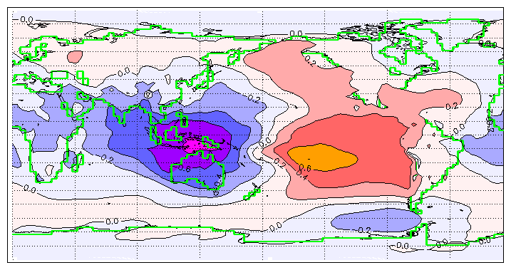
Description: Southern oscillation index correlated with mean sea level pressure; calculated from monthly deseasonalised data from ERA-15.
Title: Soi-map
Credit: Own work
Author: By William M. Connolley.
Usage Terms: Attribution-ShareAlike 3.0
License: Cc-by-sa-3.0
License Link: https://creativecommons.org/licenses/by-sa/3.0/
Image usage
The following page links to this image:

All content from Kiddle encyclopedia articles (including the article images and facts) can be freely used under Attribution-ShareAlike license, unless stated otherwise.