
Image: South Bailey, Durham - geograph.org.uk - 1618254
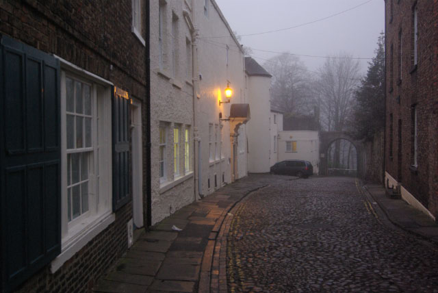
Description: South Bailey, Durham A loop of the River Wear effectively creates a peninsula on which the oldest part of Durham City stands. A street heads along it from the Market Place, first as Saddler Street, then North Bailey and finally South Bailey to the Water Gate, ahead in this picture. Beyond that is Prebends Bridge over the river. In this scene the light of a winter's afternoon is fading fast but the single street lamp seems to cast a comforting glow.
Title: South Bailey, Durham - geograph.org.uk - 1618254
Credit: From geograph.org.uk
Author: Stephen McKay
Usage Terms: Creative Commons Attribution-Share Alike 2.0
License: CC BY-SA 2.0
License Link: http://creativecommons.org/licenses/by-sa/2.0
Attribution Required?: Yes
Image usage
The following page links to this image:
