
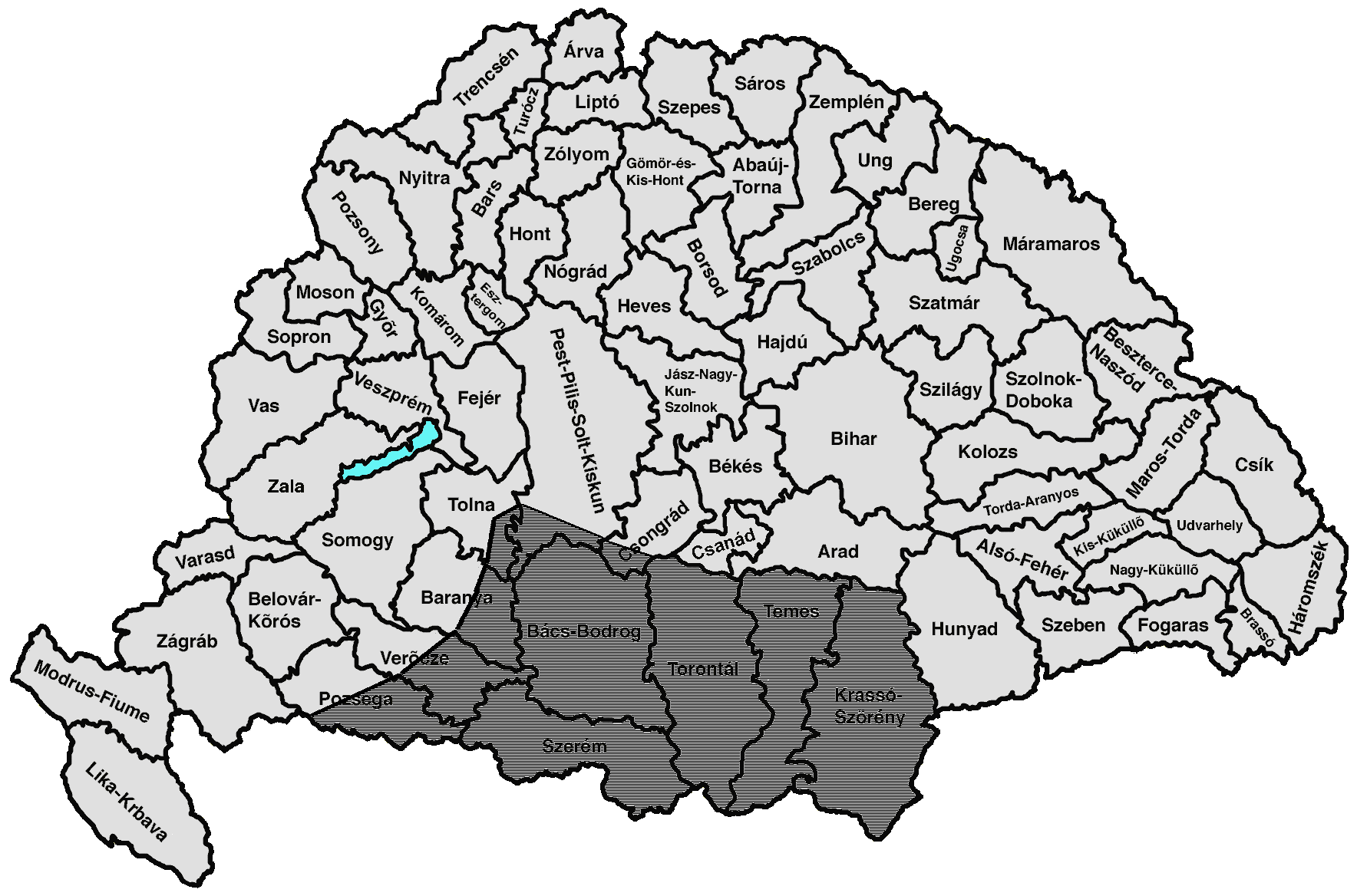
Image: Southern destruction in the Kingdom of Hungary
Size of this preview: 800 × 529 pixels. Other resolutions: 320 × 211 pixels | 1,768 × 1,168 pixels.
Original image (1,768 × 1,168 pixels, file size: 86 KB, MIME type: image/png)
Description: The boundaries of the almost complete destruction of the Hungarian settlement areas during the Ottoman occupation of Hungary Source: HÓMAN–SZEKFŰ, Magyar Történet, BUDAPEST, 1928 http://mek.niif.hu/00900/00940/html/img/nagy/42de.jpg Source for the map: https://commons.wikimedia.org/wiki/File:Csanad.png
Title: Southern destruction in the Kingdom of Hungary
Credit: Own work
Author: Fakirbakir
Usage Terms: Creative Commons Attribution-Share Alike 4.0
License: CC BY-SA 4.0
License Link: https://creativecommons.org/licenses/by-sa/4.0
Attribution Required?: Yes
Image usage
The following page links to this image:

All content from Kiddle encyclopedia articles (including the article images and facts) can be freely used under Attribution-ShareAlike license, unless stated otherwise.