
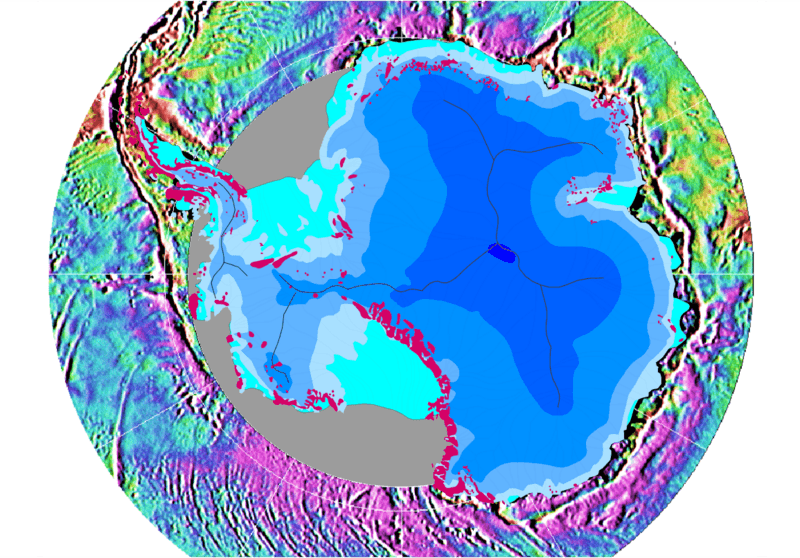
Image: Southern ocean gravity hg

Description: Gravity map of the Southern Ocean around the Antarctic continent This gravity field was computed from sea-surface height measurements collected by the US Navy GEOSAT altimeter between March, 1985, and January, 1990. The high density GEOSAT Geodetic Mission data that lie south of 30 deg. S were declassified by the Navy in May of 1992 and contribute most of the fine-scale gravity information. The Antarctic continent itself is shaded in blue depending on the thickness of the ice sheet (blue shades in steps of 1000 m); light blue is shelf ice; gray lines are the major ice devides; pink spots are parts of the continent which are not covered by ice; gray areas have no data.
Title: Southern ocean gravity hg
Credit: Antarctic continent: own work; gravity field: NOAA/NGDC (Marks, McAdoo & Smith)
Author: Hannes Grobe, AWI
Permission: Own work and public domain of NOAA
Usage Terms: Public domain
License: Public domain
Attribution Required?: No
Image usage
The following page links to this image:
