
Image: StAugustine1702Siege

Size of this preview: 800 × 404 pixels. Other resolutions: 320 × 161 pixels | 1,100 × 555 pixels.
Original image (1,100 × 555 pixels, file size: 197 KB, MIME type: image/jpeg)
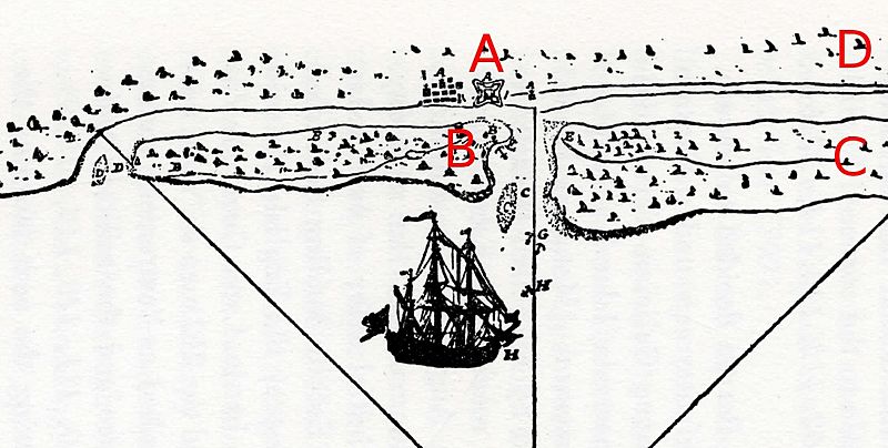
Description: Detail from a period French map depicting the 1702 Siege of St. Augustine. Image has been cropped and annotated as follows: A: Location of town of St. Augustine and the Castillo de San Marcos B: Island across the Matanzas River channel. This is where the English landed their boats; the Spanish reinforcements were landed on the other end of the island. C: The retreat route of James Moore D: The arrival and retreat route of Robert Daniel
Title: StAugustine1702Siege
Credit: Scanned from Charles Arnade, The Siege of St. Augustine, 1959. Original is from the Library of Congress, #WL 255.
Author: unknown French author
Usage Terms: Public domain
License: Public domain
Attribution Required?: No
Image usage
The following page links to this image:

All content from Kiddle encyclopedia articles (including the article images and facts) can be freely used under Attribution-ShareAlike license, unless stated otherwise.