
Image: Stanislausrivermap

Size of this preview: 587 × 599 pixels. Other resolutions: 235 × 240 pixels | 684 × 698 pixels.
Original image (684 × 698 pixels, file size: 221 KB, MIME type: image/jpeg)
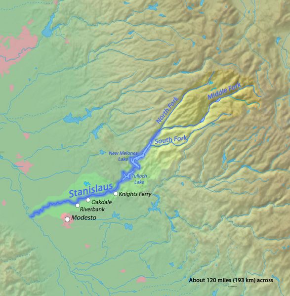
Description: Map of the Stanislaus River, a major tributary of the San Joaquin River, in Northern California. The Stanislaus River drains a long, narrow area of the western Sierra Nevada and the northern part of the San Joaquin Valley.
Title: Stanislausrivermap
Credit: Background and river course data from http://www2.demis.nl/mapserver/mapper.asp and http://seamless.usgs.gov/website/seamless/viewer.htm, both public domain
Author: Shannon (talk · contribs)
Usage Terms: Creative Commons Attribution-Share Alike 4.0
License: CC BY-SA 4.0
License Link: https://creativecommons.org/licenses/by-sa/4.0
Attribution Required?: Yes
Image usage
The following 2 pages link to this image:

All content from Kiddle encyclopedia articles (including the article images and facts) can be freely used under Attribution-ShareAlike license, unless stated otherwise.