
Image: StateLibQld 1 263100
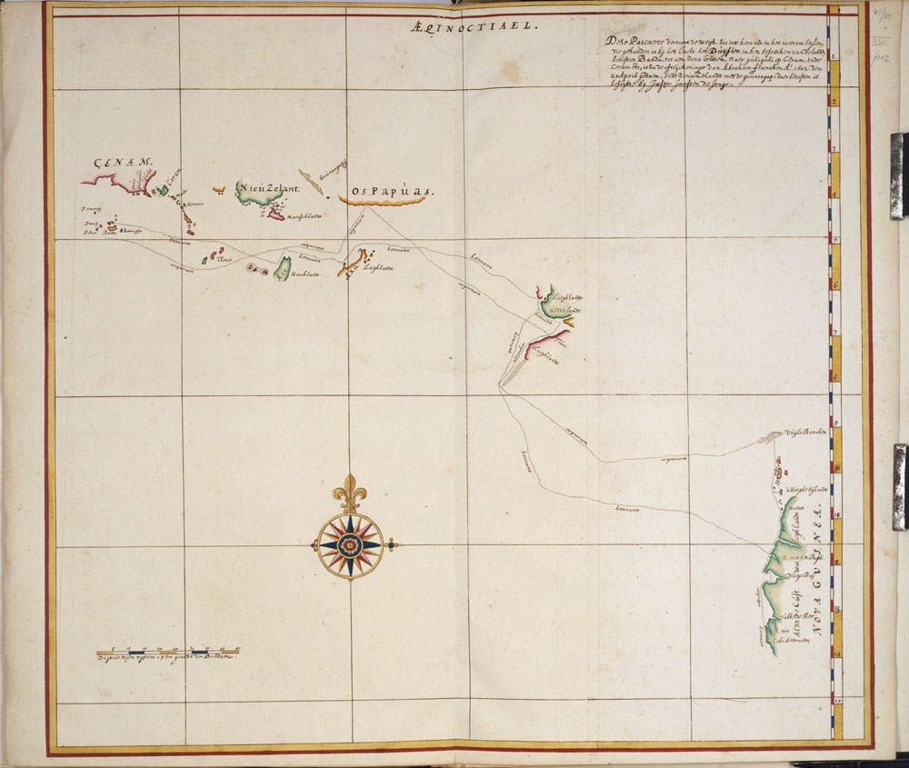
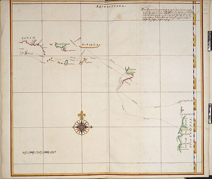
Description: The map is digitised from a copy made about 1670 of an original map drawn on board the Duyfken during her voyage of discovery along the Australian coast in 1606 from the Atlas Van der Hem, one of the treasures of the Oesterreichische Nationalbibliothek in Vienna, Austria. The legend of the map states that 'This map shows the route taken by the pinnace Duifien on the outward as well as on the return voyage when she visited the countries east of Banda up to New Guinea'. Of most importance to Queenslanders is the fact that the map identifies the first landfall of the Duyfken on Australian soil as being at 11 degrees 45' S, the present day Pennefather River, where the map states 'R. met het Bosch'. Referenced by Gunter Schilder in his book: Australia unveiled : the share of the Dutch navigators in the discovery of Australia. Amsterdam : Theatrum Orbis Terrarum, 1976, pages 286-287.
Title: StateLibQld 1 263100
Credit: Copied and digitised from Dese Pascaerte vertoont de wegh, soo int heen als in het weerom seylen, die gehouden is bij het Jacht het Duijfien in het besoecken van de landen beoosten Banda, tot aen Nova Guinea, Maer Guili-guli op Cenam, ende Caram etc, is na de afteijckeninge van Abraham Francken A. 1602. den 20 April gedaen, Ende Nieuw Zelandt met de Gounongapi daer beoosten is beseijlt, bij Jasper Janssen de Jonge [Amsterdam : s.n., 1670]
Author: Contributor(s): Oesterreichische Nationalbibliothek. Bildarchiv.
Usage Terms: Public domain
License: Public domain
Attribution Required?: No
Image usage
The following page links to this image:
