
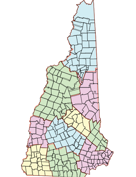
Image: State of New Hampshire with Counties and Towns

Size of this PNG preview of this SVG file: 463 × 599 pixels. Other resolution: 185 × 240 pixels.
Original image (SVG file, nominally 612 × 792 pixels, file size: 1.03 MB)
Description: Map of the State of New Hampshire Counties and Towns Based on GIS Information found in the map “New Hampshire Political Boundaries,” available through NH GRANIT, Complex Systems Research Center, University of New Hampshire, created from Digital Line Graphs from US Geological Survey data (April 2009) Adapted by Margo Burns, October 11, 2014
Title: State of New Hampshire with Counties and Towns
Credit: Own work
Author: Ogram
Usage Terms: Creative Commons Zero, Public Domain Dedication
License: CC0
License Link: http://creativecommons.org/publicdomain/zero/1.0/deed.en
Attribution Required?: No
Image usage
The following page links to this image:

All content from Kiddle encyclopedia articles (including the article images and facts) can be freely used under Attribution-ShareAlike license, unless stated otherwise.