
All content from Kiddle encyclopedia articles (including the article images and facts) can be freely used under Attribution-ShareAlike license, unless stated otherwise.
 |
|

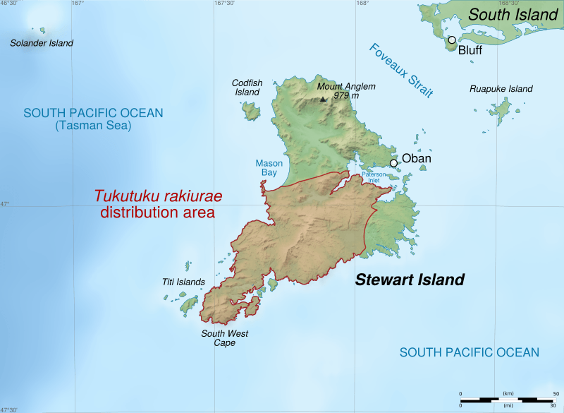
Description: Distribution map of Harlequin gecko (Tukutuku rakiurae, formerly Hoplodactylus rakiurae) on Stewart Island, New Zealand. Altitude levels: 50 m, 125, 250, 500, etc. (same for bathymetry). Projection: New Zealand Geodetic Datum 2000 ; GRS80 datum. Standard meridian: 167°45' E True scale parallel: 47° S Geographic limits of the map: West: 166.75 E East: 168.75 E North: 46.5 S South: 47.5 S
Title: Stewart Island - Tukutuku rakiurae distribution map-en
Credit: Shorelines: NASA Shuttle Radar Topography Mission (SWBD) (public domain) ; Topography: NASA Shuttle Radar Topography Mission (SRTM3 v.2) (public domain) ; Bathymetry: NGDC ETOPO1 (public domain) ; Tukutuku rakiurae distribution : File:Range H. rakiurae.png by Goodshort and Ulfl under licence cc-by-sa-3.0.
Author: Sémhur (talk)
Usage Terms: Creative Commons Attribution-Share Alike 4.0
License: CC BY-SA 4.0
License Link: https://creativecommons.org/licenses/by-sa/4.0
Attribution Required?: Yes
The following page links to this image: