
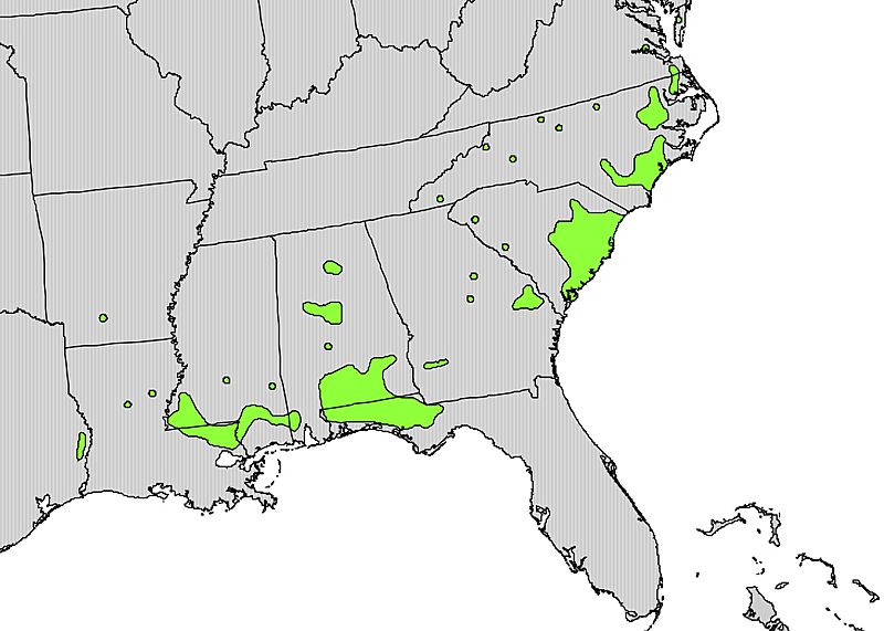
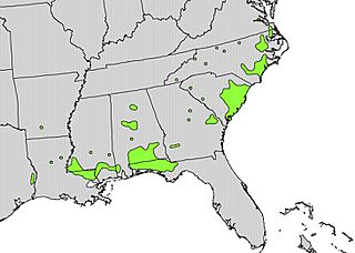
Image: Stewartia malacodendron range map

Size of this preview: 800 × 571 pixels. Other resolutions: 320 × 228 pixels | 975 × 696 pixels.
Original image (975 × 696 pixels, file size: 242 KB, MIME type: image/jpeg)
Description: Range map of Stewartia malacodendron
Title: Stewartia malacodendron range map
Credit: http://en.wikipedia.org/wiki/File:Stewartia_malacodendron_range_map.jpg Digital representation of "Atlas of United States Trees" by Elbert L. Little, Jr. [1]
Author: U.S. Geological Survey
Permission: This image is in the public domain in the United States because it only contains materials that originally came from the United States Geological Survey, an agency of the United States Department of the Interior. For more information, see the official USGS copyright policy.
Usage Terms: Public domain
License: Public domain
Attribution Required?: No
Image usage
The following page links to this image:

All content from Kiddle encyclopedia articles (including the article images and facts) can be freely used under Attribution-ShareAlike license, unless stated otherwise.