
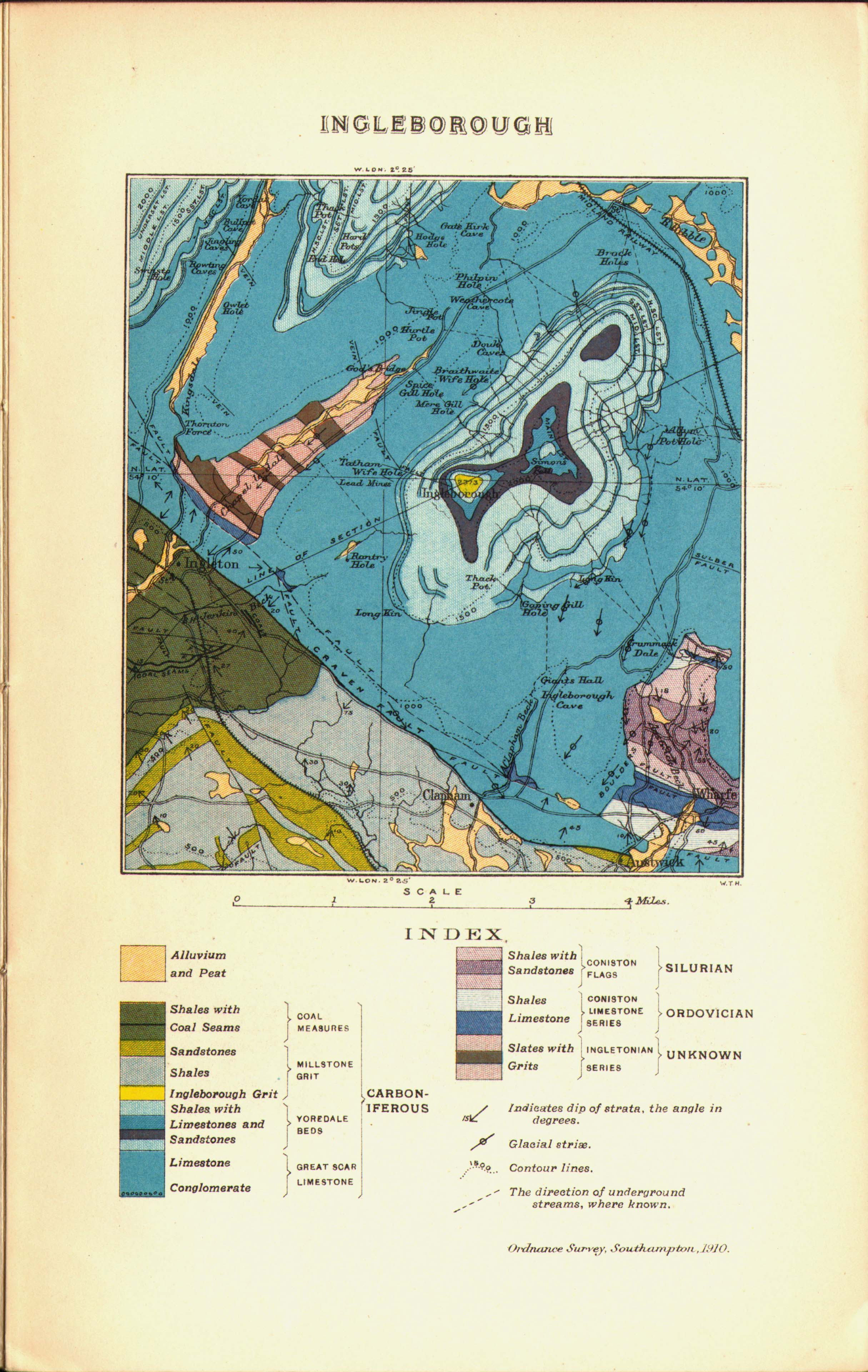
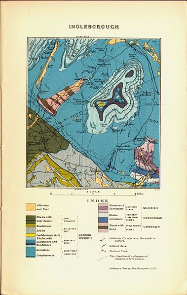
Image: Strahan Geological Map Ingleborough 1910
Size of this preview: 379 × 599 pixels. Other resolutions: 152 × 240 pixels | 2,430 × 3,840 pixels.
Original image (2,430 × 3,840 pixels, file size: 801 KB, MIME type: image/jpeg)
Description: Geological Map of Ingleborough. From Guide to the Geological Model of Ingleborough and District
Title: Strahan Geological Map Ingleborough 1910
Credit: Scan of original map
Author: Aubrey Strahan
Usage Terms: Public domain
License: Public domain
Attribution Required?: No
Image usage
The following page links to this image:

All content from Kiddle encyclopedia articles (including the article images and facts) can be freely used under Attribution-ShareAlike license, unless stated otherwise.