
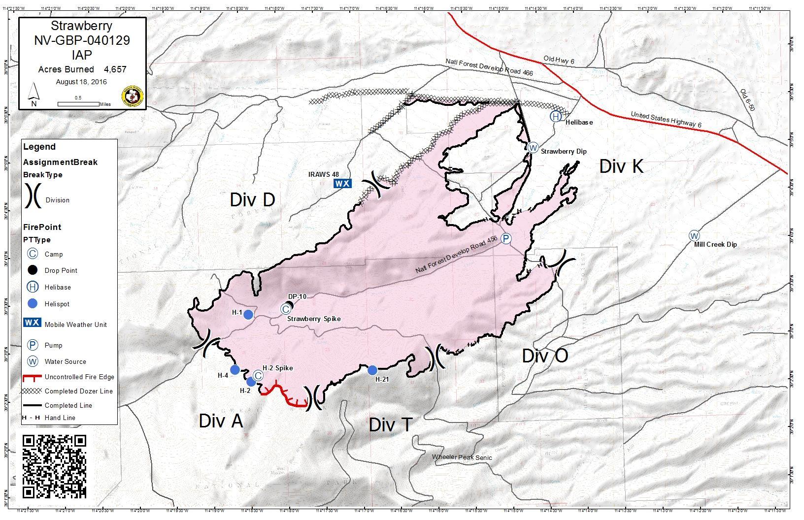
Image: Strawberry Fire Perimeter Map August 18, 2016
Size of this preview: 800 × 518 pixels. Other resolutions: 320 × 207 pixels | 1,632 × 1,056 pixels.
Original image (1,632 × 1,056 pixels, file size: 350 KB, MIME type: image/jpeg)
Description: IR Map of the Strawberry Fire August 18, 2016
Title: Strawberry Fire Perimeter Map August 18, 2016
Credit: http://inciweb.nwcg.gov/photos/NVELD/2016-08-11-1132-Strawberry-Fire/picts/2016_08_18-12.13.32.668-CDT.jpeg
Author: InciWeb
Usage Terms: Public domain
License: Public domain
Attribution Required?: No
Image usage
The following page links to this image:

All content from Kiddle encyclopedia articles (including the article images and facts) can be freely used under Attribution-ShareAlike license, unless stated otherwise.