
Image: Sulawesi blank map

Size of this preview: 542 × 599 pixels. Other resolutions: 217 × 240 pixels | 1,000 × 1,105 pixels.
Original image (1,000 × 1,105 pixels, file size: 40 KB, MIME type: image/png)
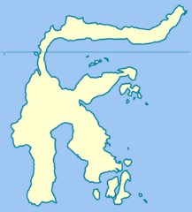
Description: Blank map of the island of Sulawesi, and its nearest islands
Title: Sulawesi blank map
Credit: Based on File:Sulawesi blank map.svg, itself taken from Image:Indonesia_provinces_blank_map.svg
Author: Ruhrfisch (talk)
Permission: GFDL, CC-BY-SA
Usage Terms: Creative Commons Attribution-Share Alike 4.0
License: CC BY-SA 4.0
License Link: https://creativecommons.org/licenses/by-sa/4.0
Attribution Required?: Yes
Image usage
The following page links to this image:

All content from Kiddle encyclopedia articles (including the article images and facts) can be freely used under Attribution-ShareAlike license, unless stated otherwise.