
Image: Sundarbans
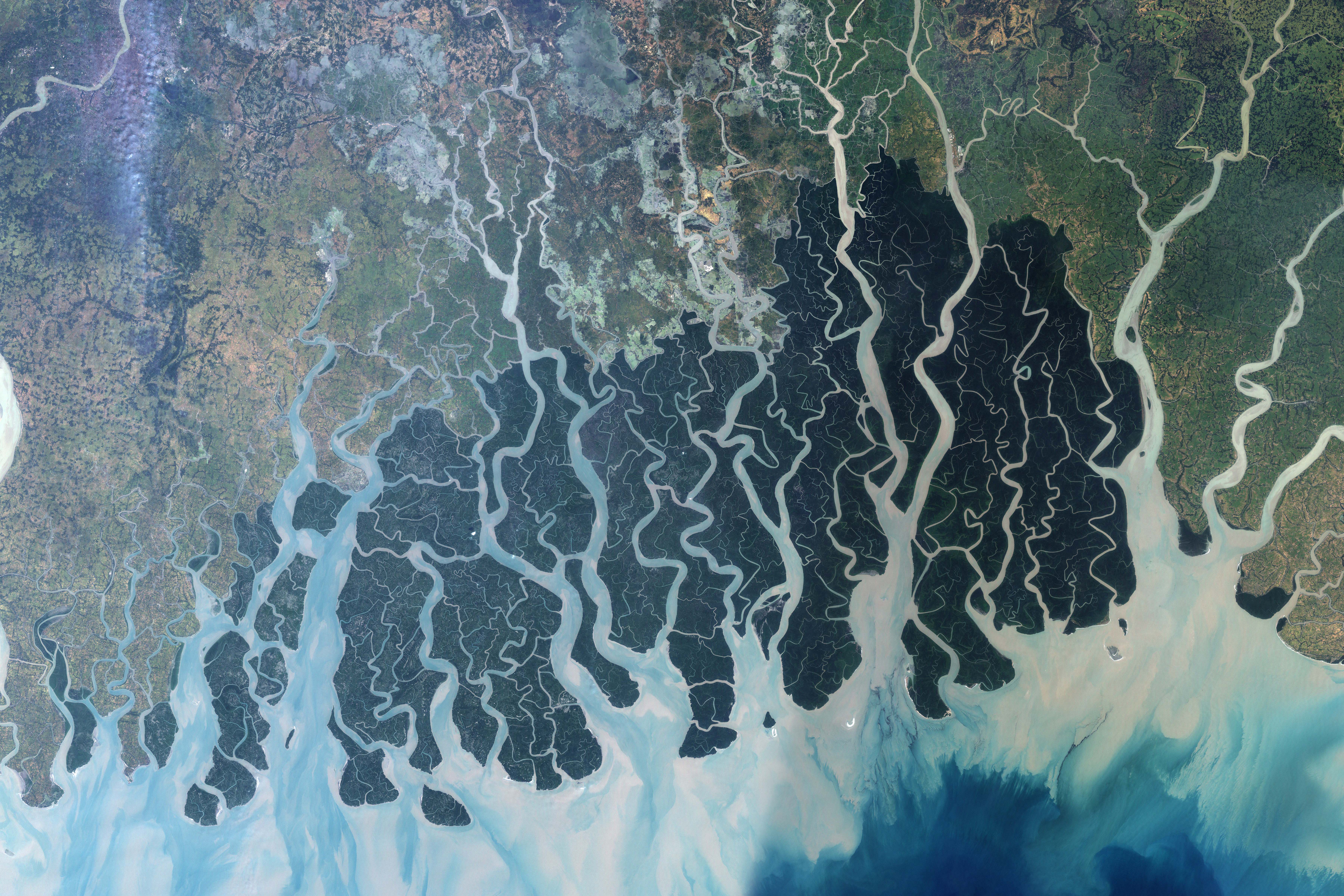
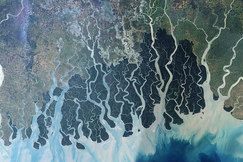
Description: This NASA satellite image was created by merging Landsat 7 satellite observations from November 24, 1999, and November 17 and 26, 2000. It shows the forest in the protected area. The Sundarbans appears deep green, surrounded to the north by a landscape of agricultural lands, which appear lighter green, towns, which appear tan, and streams, which are blue. Ponds for shrimp aquaculture, especially in Bangladesh, sit right at the edge of the protected area, a potential problem for the water quality and biodiversity of the area. The forest may also be under stress from environmental disturbance occurring thousands of kilometers away, such as deforestation in the Himalaya Mountains far to the north. NASA image created by Jesse Allen, Earth Observatory, using data obtained from the University of Maryland’s Global Land Cover Facility.
Title: Sundarbans
Credit: [1]
Author: NASA image created by Jesse Allen, Earth Observatory, using data obtained from the University of Maryland’s Global Land Cover Facility.
Usage Terms: Public domain
License: Public domain
Attribution Required?: No
Image usage
The following page links to this image:
