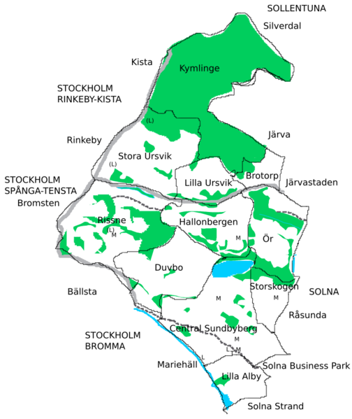
Image: Sundbyberg municipality districts

Description: Solid black line delineate districts in Sundbyberg municipality. Light gray lines show major roads. Dashed grey lines show rail. Light blue shows lakes. Green shows forests, meadows, parks and pastures. T: commuter and intercity train station, M: metro station, L: light rail station, (L): planned light rail station as of 2020
Title: Sundbyberg municipality districts
Credit: Freely drawn based on based on Sundybergskartan, from the municipality homepage ("Till Sundbybergskartan" at https://www.sundbyberg.se/bygga-bo-miljo/kartor-och-mattjanster.html) and planned light rail (https://www.sll.se/tvarbanan-kista-helenelund).
Author: Narayanese
Usage Terms: Creative Commons Attribution-Share Alike 4.0
License: CC BY-SA 4.0
License Link: https://creativecommons.org/licenses/by-sa/4.0
Attribution Required?: Yes
Image usage
The following page links to this image:

